Subject: Panama
Period: 1952 (circa)
Publication:
Color: Printed Color
Size:
23.7 x 15.9 inches
60.2 x 40.4 cm
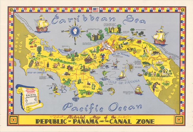
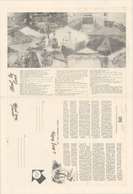
This vibrant pictorial map was issued by the U.S. Army Caribbean's Engineer Reproduction Plant as an official souvenir for forces stationed in Panama. It delineates the Panama Canal Zone, an unincorporated territory controlled by the United States between 1903-79 as it was involved in the construction and management of the canal. The map is loaded with illustrated references to the history, culture, and wildlife of the region. The ships and routes of Columbus, Bastidas, and Pizarro are pictured, and Balboa is depicted sighting the Pacific from a mountain peak. Among the other sites shown on this charming souvenir map are the iguana ("considered good eating by natives"), old Spanish gold mines, native cayucos, the ruins of Old Panama, Nata Church ("oldest church still in use on the continent"), Fort San Lorenzo, and the penal colony on Coiba Island. Surrounded by a decorative border that incorporates both the Panamanian and U.S. flag. Text and black & white photographs on verso provide additional information about the Panama Canal.
References: Rumsey #9840.002.
Condition: A
Minor wear along the fold lines.