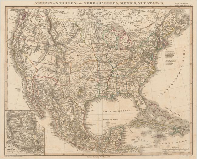
Subject: United States & Mexico
Period: 1853 (dated)
Publication: Stieler's Hand-Atlas
Color: Hand Color
Size:
15.6 x 12.4 inches
39.6 x 31.5 cm
This handsome German map shows the important territorial acquisitions of the Mexican-American War, pre-Gadsden Purchase, plus the new state of California. There are interesting territorial boundaries in the western US, including Yutah Territ., which encompasses Nevada, and Oregon Territory extending to the Continental Divide, and New Mexico extending to California. Minnesota Territory includes part of the Dakotas and the huge Nebraska Territory rests between the Continental Divide and Minnesota, with Indian Territory bordering on to the southeast. Texas is shown in an early configuration with the panhandle extending to Nutria order Nord Canada River. An inset details the Plateau von Mexico including the salt marsh of the Texcoco Lake (Texcuco See). Numerous Indian tribes are located throughout the map.
References:
Condition: B+
Contemporary outline color with light soiling and foxing.