Subject: Central Virginia
Period: 1950 (circa)
Publication:
Color: Black & White
Size:
15 x 9.3 inches
38.1 x 23.6 cm
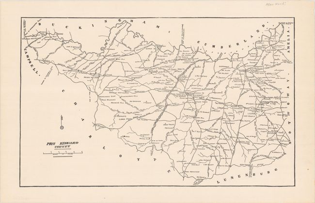
This detailed map of Prince Edward County shows landowners, businesses, roads, rivers, and bridges. It is a copy of an 1820 map by John Wood. John Wood (c. 1775-1822) was born in Scotland and emigrated to the United States at the turn of the century. He was a writer, teacher, mathematician and mapmaker during his career, settling in Petersburg, Virginia. In 1819 he signed a contract to produce maps of the counties in Virginia, and completed 26 of them before his death on 16 May 1822. Wood's maps are known to be some of the earliest county maps in Virginia that included landowner information.
References:
Condition: A+
Clean and bright on paper with a "Bay Path Bond Strathmore Quality" watermark.