Subject: Virginia
Period: 1930 (dated)
Publication:
Color: Printed Color
Size:
27.1 x 20.1 inches
68.8 x 51.1 cm
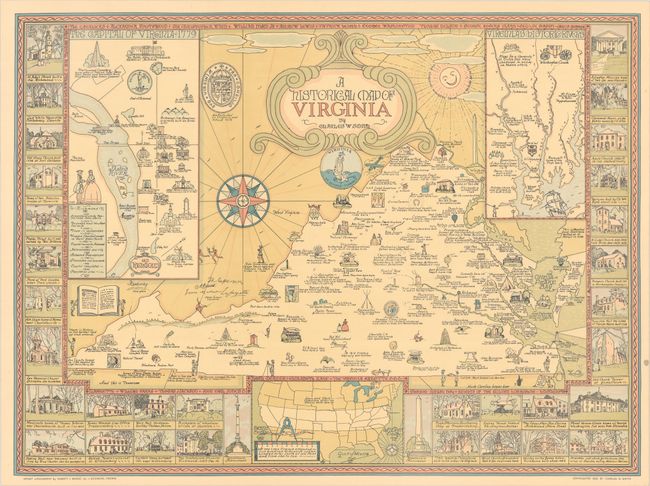
This charming pictorial map of Virginia was created by Charles Smith, an artist turned pictorial cartographer. It includes no modern map details, but instead focuses on the rich history of the state. Numerous illustrations fill the map showing landmarks, notable individuals, natural features, and historical notes. Features insets of "Old Richmond" and of Virginia's four major rivers that empty into the Chesapeake Bay. Surrounding the main map image are vignettes of important buildings across the state including Monticello, Ash Lawn, and Mount Vernon to name a few. Further decorated by an elaborate 16-point compass rose, the state seal, and a rather clunky strapwork title cartouche. This map was published in two different editions - a larger edition (31.9 x 23.5") lithographed by A. Hoen & Co. and this smaller edition lithographed by Garrett & Massie Inc.
References:
Condition: A
A soft crease at bottom left and a small stain in the right blank margin.