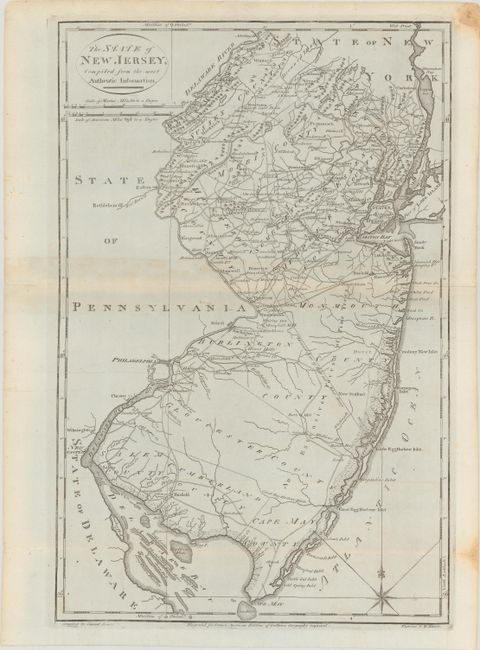
Subject: New Jersey
Period: 1795 (circa)
Publication: American Atlas
Color: Black & White
Size:
12.3 x 18.7 inches
31.2 x 47.5 cm
Handsome topographical map showing counties, the division line of East from West Jersey, towns, mills, courthouses and many roads. Carey's American Atlas was originally issued in 1795 to accompany the American edition of Guthrie's Geography Improved, and it was subsequently issued into the early nineteenth century. This is the first state of the plate without a plate number. Compiled by Samuel Lewis and engraved by W. Barker.
References: Wheat & Brun #414.
Condition: B+
A nice impression with light toning along the centerfold, a short tear at bottom that has been closed on verso with archival tape, two stains in the right blank margin, and a short tear in the right blank margin.