Subject: Missouri
Period: 1838 (dated)
Publication:
Color: Hand Color
Size:
14.1 x 11.8 inches
35.8 x 30 cm
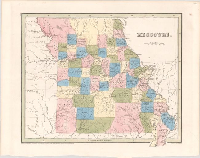
This handsome atlas map depicts the state just prior to its boundary dispute with Iowa Territory. County configuration is roughly current to 1837, with the newly acquired Platte Country in the northwest. The vast central portion of the Platte Purchase is unnamed. New counties include Livingston, Linn, Macon, and Miller; there is no sign of Shannon. The area beyond the state's western border is labeled Indian District. Independence, St. Louis, and Jefferson City are all identified. Engraved by G.W. Boynton.
References:
Condition: A
Contemporary color on a bright sheet.