Subject: Upper Peninsula, Michigan
Period: 1847 (circa)
Publication:
Color: Hand Color
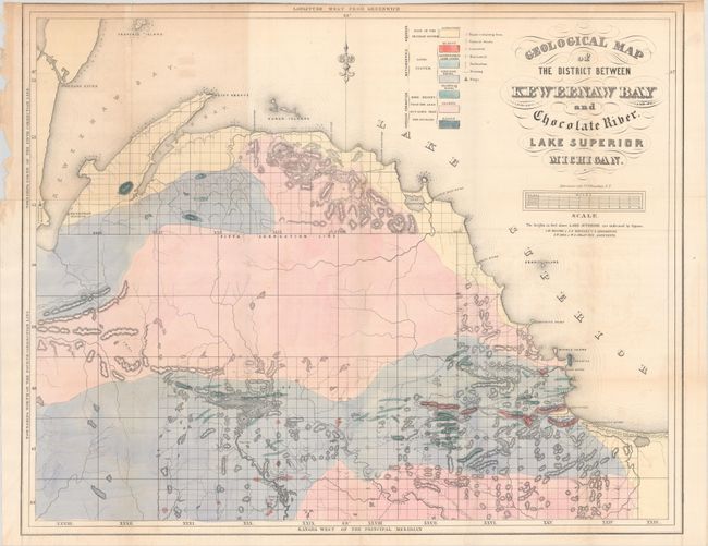
A. Geological Map of the District Between Keweenaw Bay and Chocolate River. Lake Superior Michigan (24.4 x 19.6"). This detailed geological map covers the region from the Keweenaw Bay to the Chocolate River. A color-coded key locates seven geological types, including sandstone, quartz, limestone, schistose and trappean rocks, granite and basalt. There is also good detail of relief shown in hachure. A scale below the title converts chains to miles. Fancy title lettering.
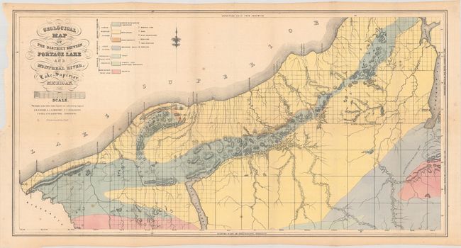
B. Geological Map of the District Between Portage Lake and Montreal River, Lake Superior, Michigan (29.6 x 15.4"). Covers the area from the Michigan/Wisconsin border to Keweenaw Bay with a color-coded key locating seven geological types. Locates both a Catholic and Methodist mission along Keweenaw Bay with several trails extending into the unsurveyed interior.
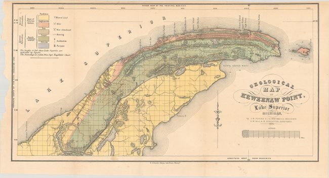
C. Geological Map of Keweenaw Point, Lake Superior Michigan (20.5 x 10.6"). This is a very detailed geological map that covers the region from Portage Lake to the tip of the point and also shows Manitou Island. A color-coded key locates geological units including sandstone, conglomerate, trap and jasper. The legend locates minerals, active and abandoned mines, and furnaces.
References: Marcou & Marcou #366 & #369; Karpinski (MI) #758b, 766 & 767.
Condition: B+
Colorful examples with occasional light toning, offsetting and scattered foxing. The upper left side margins are chipped but away from the image.