Subject: Florida
Period: 1846 (dated)
Publication: A New Universal Atlas...
Color: Hand Color
Size:
11.7 x 14.4 inches
29.7 x 36.6 cm
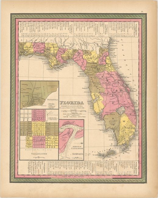
This is a revised edition of Tanner's map of Florida showing towns, railroads, forts, roads, canals, major rivers, and lakes. There are references to forts, battlefields, and routes used by the Army during the Seminole War. There are also three inset maps detailing Pensacola, Tallahassee, and St. Augustine. The map reflects the configuration of counties in 1843, although Mosquito County is far too large. Water routes from St. Augustine and Pensacola to various ports are described along the upper and lower margins. Printed by H.N. Burroughs.
References:
Condition: B+
Contemporary color with light toning and soiling and a horizontal extraneous crease.