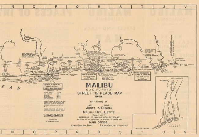
Subject: Malibu, California
Period: 1949 (dated)
Publication:
Color: Black & White
Size:
29.6 x 8.1 inches
75.2 x 20.6 cm
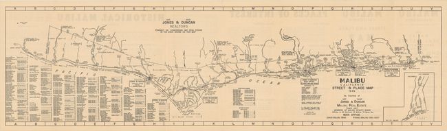
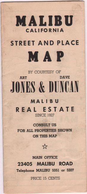
A detailed promotional map drawn by A. Cowles Daley and published by realtors Art Jones and Dave Duncan, who were responsible for much of the early development in Malibu. This very desirable and exclusive stretch of coastline was last owned by the Rindge family from 1892-1927, before constant lawsuits and eminent domain wrestled away control of this 13,330 acre rancho. The map was issued about 20 years after its initial subdivision and reveals remarkable development including numerous individual business, ranches, beaches, piers, canyon roads, and more. Includes an extensive street index at bottom left. The verso features text panels including "Places of Interest" and "Historical Malibu." Duncan concludes the verso text by stating "another great Spanish Grant has given way to the pressure of the miraculous growth of the California Southland and a fascinating community has come into being." Self-folding (3.9 x 8.9"). No institutional examples were located on OCLC.
References:
Condition: A
Issued folding. Minor soiling on the self-wrappers.