Subject: San Francisco Bay, California
Period: 1939 (dated)
Publication:
Color: Printed Color
Size:
19 x 15.7 inches
48.3 x 39.9 cm
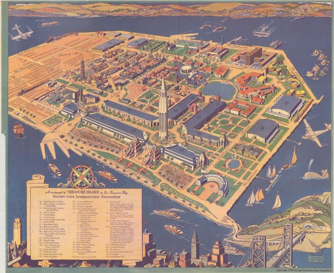
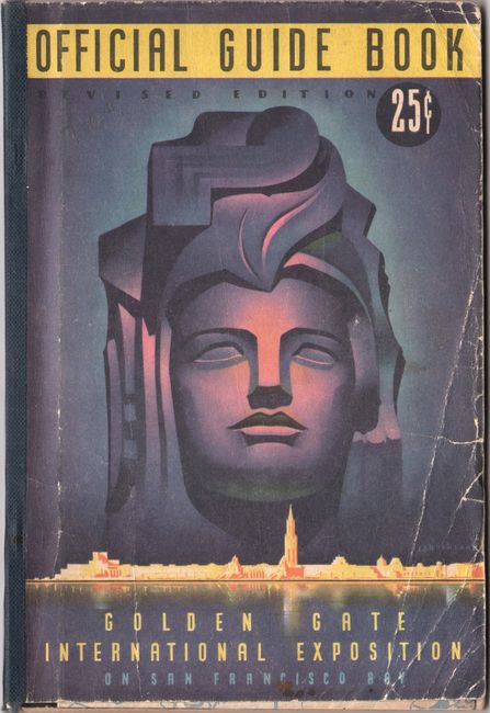
This 1939 edition pictorial map was issued in the official guide for the Golden Gate International Exposition (World's Fair) celebrating the recent opening of the two major bridges leading to San Francisco (the San Francisco-Oakland Bay Bridge opened in 1936 and the Golden Gate Bridge opened in 1937). The fair was held on Treasure Island, an artificial island created specifically for this event, in the San Francisco Bay along the route of the Bay Bridge. The map itself shows good detail of the exposition grounds with the "Tower of the Sun" in the foreground. A large scroll legend at lower left identifies 43 points of interest including the Ford Building, "Vacationland" and Treasure Garden to name a few. The verso contains an index and enlarged views of several of the exposition buildings. The map is accompanied by the 116-page official guidebook (5.5 x 8.0") filled with related text, illustrations and advertisements.
References:
Condition: A
Condition code is for the folding map, which is clean and bright with a binding trim at lower left and a couple of tiny edge tears. There are several pencil notations on verso that do not show through. Guidebook text is mostly clean and bright with a few pencil notations. Wrappers are worn with some creasing to the front wrapper.