Subject: Grand Canyon, Arizona
Period: 1882 (published)
Publication:
Color: Printed Color
Size:
16.6 x 20.2 inches
42.2 x 51.3 cm
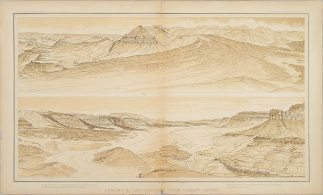
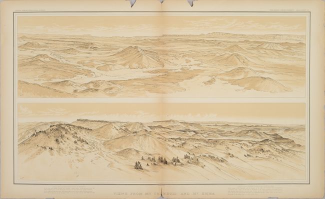
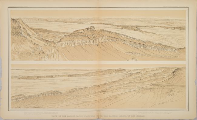
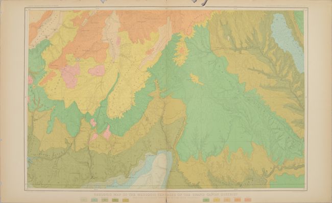
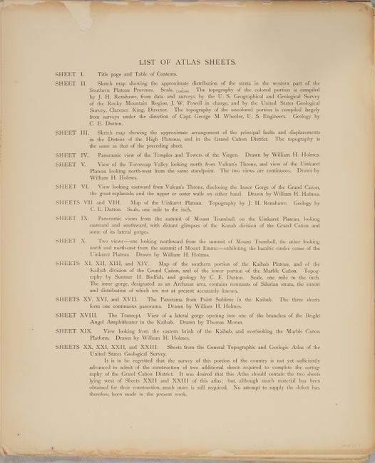
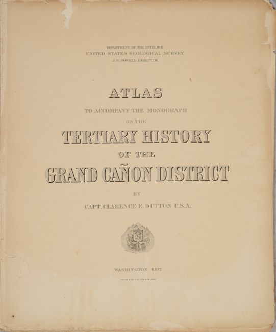
This example includes 16 of the 23 sheets from Dutton's famous atlas of the Grand Canyon, which is one of the most important works on the region ever produced. Of particular interest in this example are three views by William H. Holmes including View of the Toroweap Valley Looking North from Vulcan's Throne..., View Looking from the Eastern Brink of the Kaibab..., and two views of Mount Trumbull and Mount Emma on one sheet. In addition to the views, there are twelve geologic maps of the region (eleven in color), a title page, and table of contents. Not present are sheets 4, 6, 9, and 15-18. Lithographed by Julius Bien & Co. Disbound.
Clarence Dutton started working for the U.S. Geological Survey in 1875 and is best known for his explorations in the Colorado Plateau Province (roughly centered on the four corners region). He wrote several important papers over his career including works on the Grand Canyon, the high plateaus of Utah, as well as the Charleston earthquake of 1886.
References:
Condition: B
The plates are mostly good to very good with some light dampstaining along the bottom edges and numerous chips and edge tears mostly in the top blank margin. The last map (plate 23) has a large chip at bottom center and a small 0.5" hole at center (C condition). Title page and table of contents are heavily chipped.