Subject: Western United States
Period: 1867 (dated)
Publication:
Color: Black & White
Size:
41.6 x 26.8 inches
105.7 x 68.1 cm
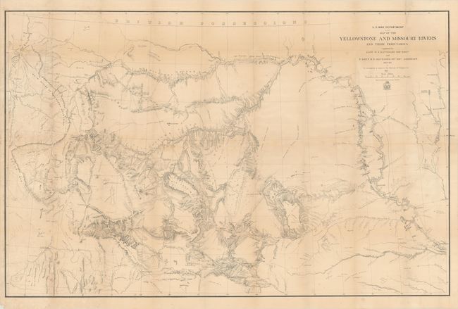
A large and very detailed map of the region explored by Capt. W.F. Raynolds in 1859-60. His report was delayed until 1866 due to the outbreak of the Civil War which sent him and his assistants off to war. While he was away, he came down with a "severe and protracted illness" which caused further delays. It was eventually completed when mining developments and conflicts with Indian tribes in the region made it important. The map includes post 1860 developments such as Ft. Casper and Camp Marshall on the upper North Platte, as well as the Tetons, Jackson's Hole, and several new forts and emigrant roads.
References: Phillips (Maps) p. 1130.
Condition: B
Issued folding with light toning and scattered foxing. A number of small fold separations have been closed on verso with archival tape, and there are two tiny areas of loss along the top left fold.