Subject: Western United States
Period: 1864-80 (circa)
Publication: McNally’s System of Geography
Color: Hand Color
Size:
8.4 x 10.6 inches
21.3 x 26.9 cm
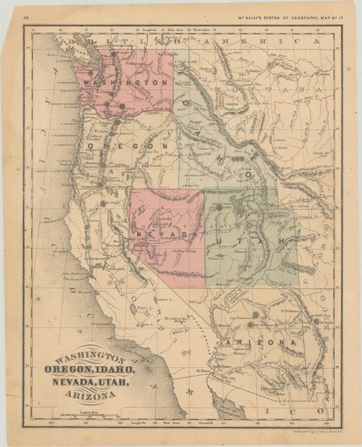
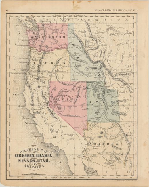
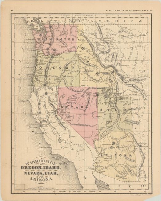
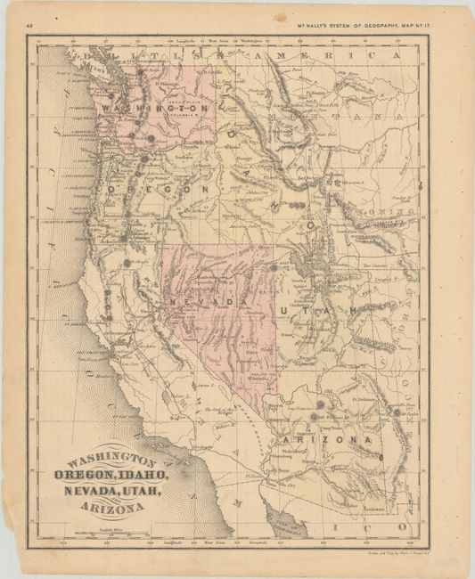
This fascinating series of Map No. 17 from McNally's System of Geography depicts the development of the western states. The maps reveal the march of progress during this critical period in the region’s history. The first map is from circa 1864 when Arizona was still in possession of the southern tip of present-day Nevada and its capital was located in Prescott. Nevada’s boundary with Utah is along the 115th meridian, and the Overland Mail Route crosses the territories and terminates in Placerville, CA. The second map jumps forward to circa 1869 with Nevada’s borders finalized. Arizona’s capital has now moved to Tucson. The Transcontinental Railroad is shown completed. The third map dates from around 1877 when Prescott once again was Arizona’s seat of government. There is considerable railroad development in northern California and western Oregon. The last map was published circa 1880 and depicts the completed Southern Pacific Railroad, Yellowstone National Park, and substantial new settlement in Oregon and Washington. The topography of the map has also been updated. Closer examination would likely reveal much else of interest.
References:
Condition: B+
The maps have faint to light soiling, scattered foxing, and/or dampstains and some marginal chipping.