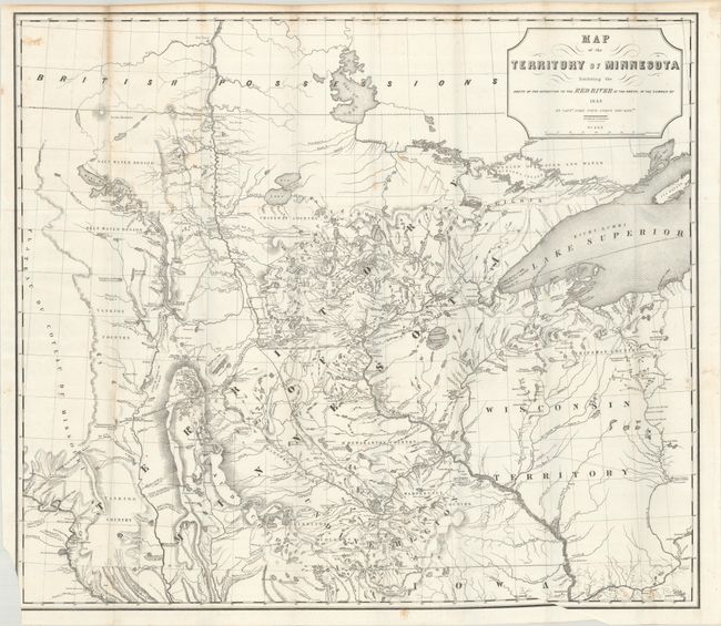
Subject: Upper Midwestern United States
Period: 1849 (dated)
Publication:
Color: Black & White
Size:
28.1 x 24.8 inches
71.4 x 63 cm
A foundation map for Minnesota from Pope's Report of an Exploration of the Territory of Minnesota. It is based on Nicollet's earlier Map of the Hydrographical Basin of the Upper Mississippi River. Pope has increased the coverage to include the Lake of the Woods and Canada (British Possessions), and added much new information on rivers and lakes. This is considered the first published map to show the newly formed territory by itself. It details Pope's route from Fort Snelling to the Red River and back. Proposed lines of railroad grants are noted and there is terrific detail of the hydrography and topography. Drawn by P.S. Morawski. A historically important map.
References: Phillips (Maps) p. 432.
Condition: B+
Issued folding on a bright sheet with some light foxing. There is minor loss of border at lower left due to an errant binder's cut.