Subject: Upper Midwestern United States
Period: 1806 (circa)
Publication:
Color: Black & White
Size:
5.9 x 7.7 inches
15 x 19.6 cm
Mathew Carey was a seminal figure in early American publishing; establishing the first publishing firm to specialize in cartography and issuing the first atlas devoted exclusively to American maps. He set up an elaborate cottage system of craftsmen for compiling, engraving, printing, and coloring maps. This practice was emulated by later American cartographic publishers such as John Melish and Henry S. Tanner. The American Atlas concept was also adopted by other publishers in both the United States and Europe.
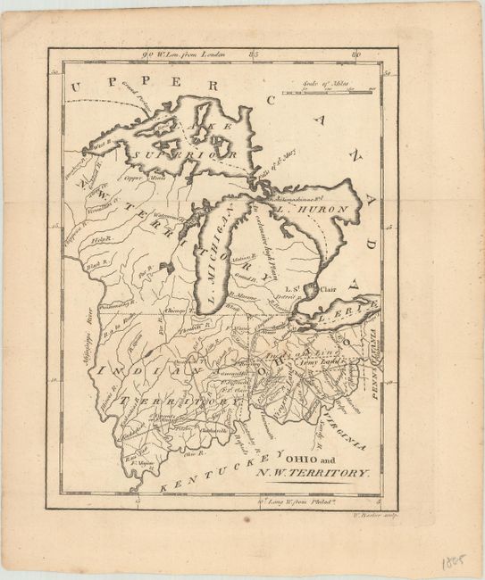
It covers the region east of the Mississippi River and north of the Ohio River, up to the Great Lakes, showing rivers, roads, and trails. Numerous forts and towns are named, including Chicago and Detroit. A large portion of Michigan is labeled as an extensive high plain and present-day Illinois and Indiana are labeled . Present-day Ohio is divided into Indian lands, Army lands, Virginia lands, and the Seven Ranges, which was the first tract to be surveyed under the Public Land Survey System. Engraved by W. Barker. This map was published in Carey's American Minor Atlas and American Pocket Atlas.
References: Howes #C-136-137.
Condition: B+
Issued folding on a lightly toned sheet with an "I G & Co." watermark and minor marginal soiling.