Subject: Central United States
Period: 1855 (dated)
Publication:
Color: Hand Color
Size:
42.3 x 34 inches
107.4 x 86.4 cm
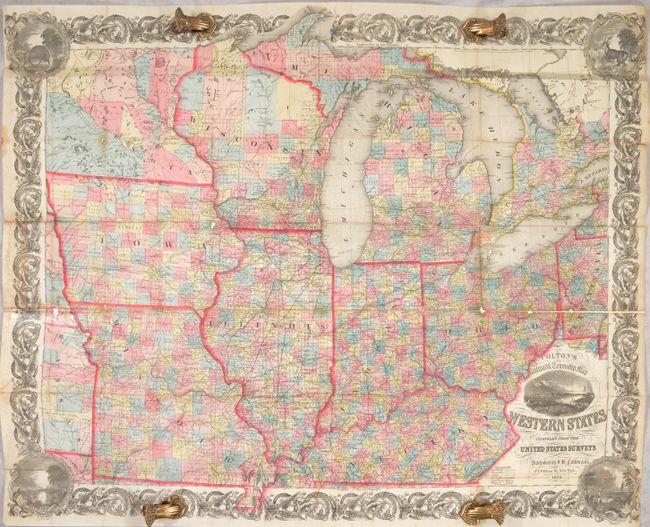
A large and beautifully detailed map of the midwestern states printed on fine banknote paper with decorative borders. Includes Ohio, Indiana, Michigan, Kentucky, Illinois, Wisconsin, Missouri, Iowa, and Minnesota. The eastern and southern parts are well developed, but northern Michigan and Wisconsin, western Iowa, and particularly Minnesota are much less organized. Absolutely filled with information on early roads, railroads, counties, towns, watershed, townships, etc. Includes vignettes of Louisville, St. Louis, Cincinnati, a bison and a buck. Folds into a green cloth slipcase with original embossed black leather front cover from pocket map embedded into the front of the slipcase.
References: Rumsey #4985.
Condition: B
Issued folding, now backed in archival tissue and refolded to fit in modern slipcase. There is light soiling mostly on the edges of the sheet, a few small areas of loss at fold intersections, and some staining at left where the map was previously glued into the covers. There is a short separation along the edge of the sheet at right.