Subject: Central & Mid-Atlantic United States
Period: 1825 (dated)
Publication:
Color: Hand Color
Size:
20.2 x 18 inches
51.3 x 45.7 cm
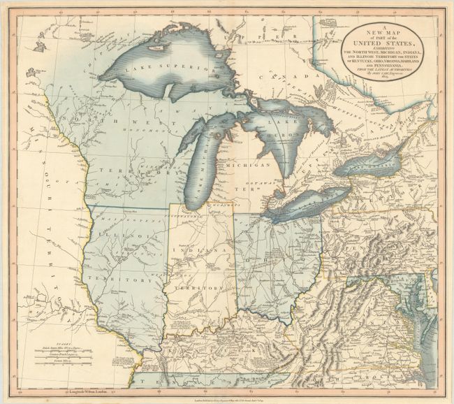
Great map of the early mid-western territories showing roads, portages, forts, Indian villages, settlements and topography. It includes numerous interesting notations, particularly relating to navigation in the Great Lakes and portages throughout the region. Lake Superior still shows the imaginary Isle Philippeaux, and native tribes are named throughout the map. The western boundary of the Six Indian Nations is shown to be a creek in western New York. An Indian Boundary Line by the Treaty under Gen. Wayne 1795 cuts through Ohio from Ft. Lawrence to Ft. Recovery in Indiana Territory and then south to the border with Kentucky. In Kentucky is a note; "this Colony was first discovered by Js. Macbride & others in the Year 1754. Col. D. Boon explored it in 1769 & with his family & five others began the first settlement in it in 1773." Although Indiana and Illinois had gained statehood in 1816 and 1818 respectively, they are still labeled as territories. The large Northwest Territory and Missouri Territory fill the regions to the north and west.
References:
Condition: A
Full contemporary color on a clean, bright sheet with a few faint spots of foxing.