Subject: World
Period: 1837 (circa)
Publication: Geographie Moderne
Color: Hand Color
Size:
18.3 x 10.8 inches
46.5 x 27.4 cm
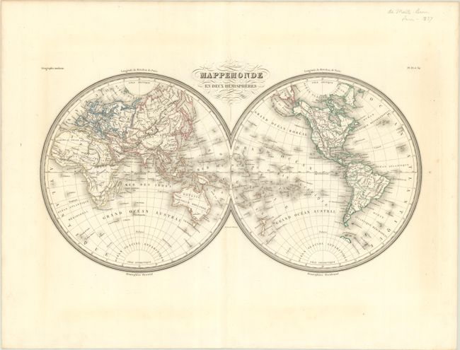
The United States and Great Britain established in 1818 joint claim over the Oregon Territory - the region north of Spanish controlled Upper California up to the southern boundary of Russia's Alaska Territory at North latitude 54°40'. By the late 1830's this arrangement was beginning to fall apart.
In the 1840's the expansionist Democrats, including their 1844 presidential candidate, James Polk, claimed the entire region for the United States. Their expansionist desires were expressed by Polk's famous campaign slogan, "Fifty-four Forty or Fight!" The slogan also became a rally cry for Americans desiring to settle the territory. Following Polk's election, the dispute was resolved by the 1846 Treaty of Oregon, which struck a compromise that fixed the U.S./Canadian boundary at 49º North.
This handsome French double-hemisphere world map focuses on political boundaries and major rivers. San Antonio is named in present-day Texas, which is not named and still shown as part of Mexico. The United States' claims in the Pacific Northwest extend far into British Columbia, reflecting the Oregon Boundary Dispute. Numerous islands are identified in the oceans. Australia is labeled Notasie ou Nouvelle Hollande. Hokkaido is Ile Iesso. A small stretch of coastline named as Tre. de la Trinite appears north of the Antarctic Circle.
References:
Condition: A
Contemporary outline color with minor toning outside the map image.