Subject: Mid-Atlantic United States
Period: 1851 (dated)
Publication:
Color: Hand Color
Size:
31.3 x 16.2 inches
79.5 x 41.1 cm
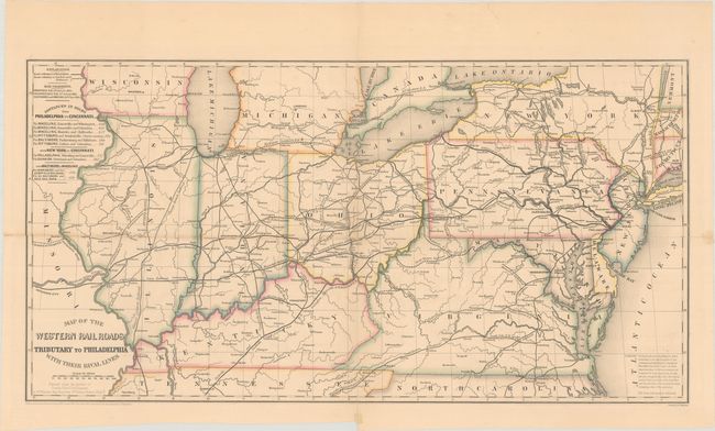
This apparently scarce map by Charles Ellet shows the evolving railroad network from the eastern seaboard to the Mississippi River. Heavy black lines indicate "roads tributary to Philadelphia" and dashed lines indicate "roads tributary to New York and Baltimore," with Philadelphia appearing to have a majority share of the western railroads compared to "their rival lines." A table at left shows distances between Philadelphia and Cincinnati, New York and Cincinnati, and Baltimore and Wheeling. Published and printed in Philadelphia by Wellington Williams. There are no past sales records and only 7 institutional holdings located on OCLC.
References: Modelski (Railroads) #80.
Condition: B
Numerous fold separations have been closed on verso with archival tape along with a small piece of archival tape on recto at the fold junction. A few edge tears confined to the top blank margin have also been archivally repaired on verso.