Subject: New England & Mid-Atlantic United States
Period: 1801 (published)
Publication: Voyage dans la Haute Pennsylvanie…
Color: Hand Color
Size:
19.7 x 14.2 inches
50 x 36.1 cm
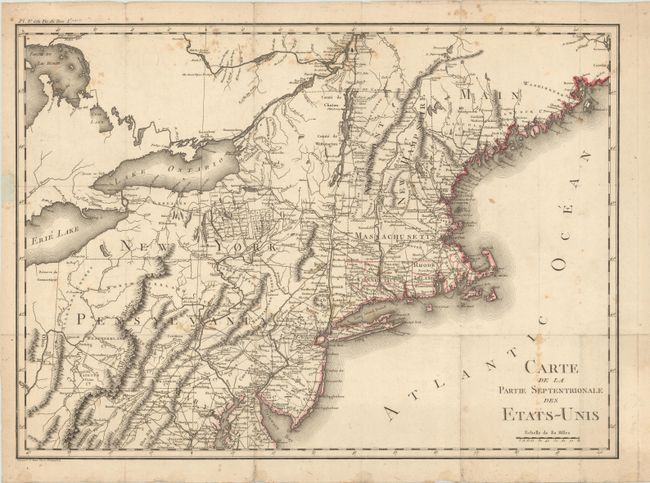
This highly detailed map extends from the northern reaches of Chesapeake Bay to Maine and eastward to show most of Lake Erie. It is filled with a remarkable number of place names and details including a surprisingly well developed road system in the nascent nation. Additionally, the map provides a large amount of information on Indian tribes and villages. Crevecoeur was a French immigrant to the United States who gain notoriety describing the emerging American national character in his Letters of an American Farmer (1782). This uncommon map was included in Volume I of Crevecoeur's work and was engraved in Paris by P.F. Tardieu. At upper left is "Pl. V. a la Fin du Tom. I." Blank verso.
References:
Condition: B+
A dark impression on watermarked paper, issued folding. There is light scattered foxing and a few short fold separations in the margins that have been closed with archival materials at bottom and along the sides.