Subject: Eastern United States
Period: 1848-50 (circa)
Publication:
Color: Hand Color
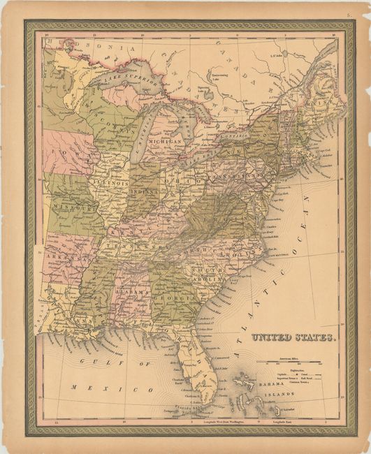
A. United States, by Samuel Augustus Mitchell, from A New Universal Atlas, circa 1848 (12.6 x 15.8). This atlas map of the eastern United States extends west of the Mississippi, all the way to the Texas-Louisiana border. It shows towns and cities, canals, and railroads. Wisconsin and Iowa are newly formed. Condition: Full contemporary color with light toning and a few small chips along the edges of the sheet. (B+)
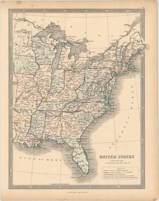
B. United States, by George Philip & Son, circa 1850 (9.2 x 11.7). This map of the eastern United States outlines each state and gives good detail of cities, rivers and the early railroad system. Wisconsin is delineated but still labeled "Northwest Territory." Condition: Full contemporary color with light toning and foxing along the edges of the sheet. (A)
References:
Condition:
See description above.