Subject: Eastern United States
Period: 1847 (dated)
Publication:
Color: Hand Color
Size:
25.5 x 21 inches
64.8 x 53.3 cm
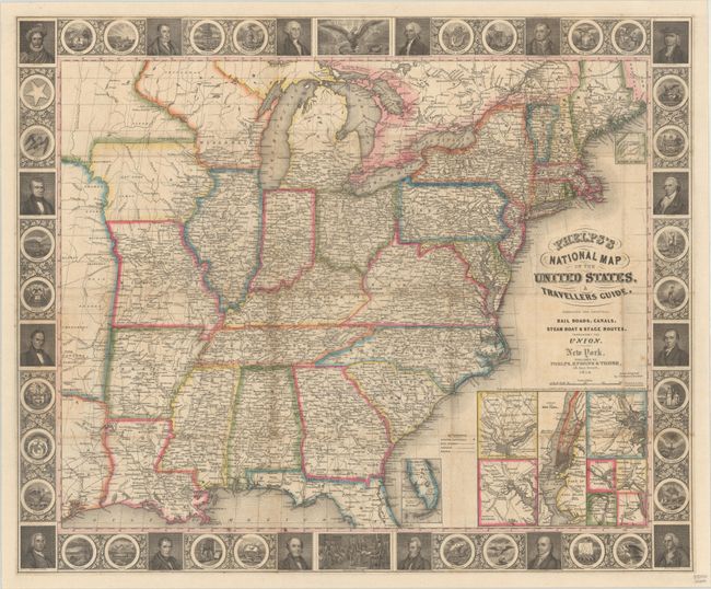
This completely re-engraved, first edition folding pocket map extends to the Great Plains and includes part of Texas with two large unnamed regions extending northward, presumably the Indian territories and western Wisconsin Territory (Iowa had just become a state in December 1846). The map is filled with details including roads, towns and villages, railroads, rivers and much more. Delineates the Trader’s Route to Santa Fe in Missouri and through the territory to the west. Names numerous Indian tribes, Burial Grounds, and trading depots. It is embellished with a surrounding border featuring finely engraved portraits of 16 famous Americans, the seals of 30 states including Texas (but not California), the signing of the Declaration of Independence, and the seal of the United States. This early edition does not have the large inset "Map of Oregon, California & Texas" that would later appear at lower right. Here the original insets include the vicinity around Baltimore, Philadelphia, Boston, New York, Pittsburgh, Cincinnati, Chicago, and St. Louis. The southern tip of Florida and the north part of Maine are shown in insets as well. Backed with heavy linen, covers not present.
References: Howes #P-291; Rumsey #0719.003.
Condition: B+
Issued folding and now flattened and backed with heavy linen. There is some light toning along a few folds and minor foxing.