Subject: Eastern United States
Period: 1837 (dated)
Publication: A New General Atlas...
Color: Hand Color
Size:
13.2 x 10.7 inches
33.5 x 27.2 cm
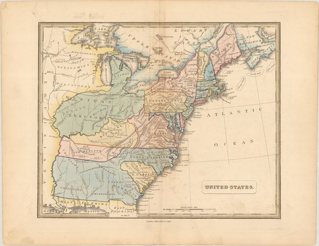
This map of the United States features very interesting, although outdated, boundaries between states and territories. Florida is still divided into East and West, and the southern states of Georgia, Alabama and Mississippi aren't delineated, although Georgia is labeled. A large Western Territory appears to the north, encompassing the states of Ohio, Indiana, Michigan, Illinois, and extending west. The names of numerous Indian tribes are identified throughout the map. Existing railroads in Pennsylvania and Massachusetts are shown, as well as a long proposed railway from Orange, NJ straight west to the Mississippi River.
References:
Condition: B+
Full contemporary color with faint offsetting, light foxing, and a short centerfold separation confined to the bottom blank margins. Small remnants of hinge tape on verso.