Subject: Eastern United States
Period: 1800 (circa)
Publication: A New and Complete System of Universal Geography
Color: Black & White
Size:
12.2 x 9.6 inches
31 x 24.4 cm
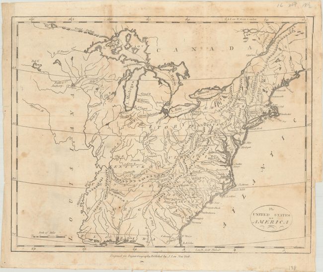
This map of the young United States covers the region from Maine south to Florida and west to the Mississippi River. Georgia's western boundary extends to include present-day Alabama and Mississippi. A large N.W. Territory stretches from Minnesota to Ohio. Several spurious islands are located in Lake Superior including I. Royal. Vermont is not named. Inland detail is limited to rivers, topography and some place names. This map was published in the American edition of Payne's Geography, printed and sold by John Low in New York.
References: McCorkle (18th C. Geography Books) #330, Vol. IV [2].
Condition: B
Issued folding with soiling and dampstaining. There is a short fold separation at left and a binding trim at right with a short, adjacent tear that have both been closed on verso with archival tape.