Catalog Archive
Auction 185, Lot 16

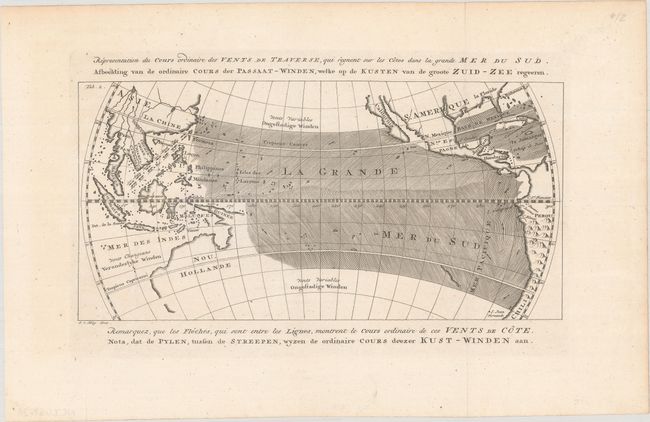
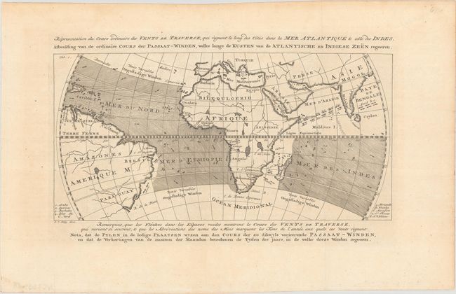
"[Lot of 2] Representation du Cours Ordinaire des Vents de Traverse, qui Regnent sur les Cotes dans la Grande Mer du Sud... [and] ... qui Regnent le Long des Cotes dans la Mer Atlantique & celle des Indes...", Prevost, Anton Francois

Subject: World

Period: 1760 (circa)

Publication: Prevost's Histoire Generale des Voyages

Color: Black & White

Size:
11.8 x 5.8 inches
30 x 14.7 cm
Download High Resolution Image
(or just click on image to launch the Zoom viewer)

These rather early thematic maps depict the wind currents across the world's major shipping routes, showing the world on an unusual oval projection. Both maps are centered on the equator and depict the currents by means of engraved directional lines. The trade winds are shown with little arrows, augmented with the names of months. The first map focuses on the Pacific and shows a portion of North America with the island of California and partial coastlines for Australia. The second map displays the winds across the Atlantic and Indian Oceans. This pair of matched maps was engraved by Van Schley, with alternate titles in Dutch. Most of the maps in Prevost's work are by Jacques Nicolas Bellin, but these maps do not contain any attribution.

References: Mickwitz & Miekkavaara #638, vol. XI, map 9 & 10.

Condition: A

Nice examples, issued folding.

Estimate: $150 - $180

Sold for: $110

Closed on 11/17/2021

Archived