Subject: Eastern North America & Caribbean
Period: 1812 (circa)
Publication:
Color: Hand Color
Size:
8.8 x 11.8 inches
22.4 x 30 cm
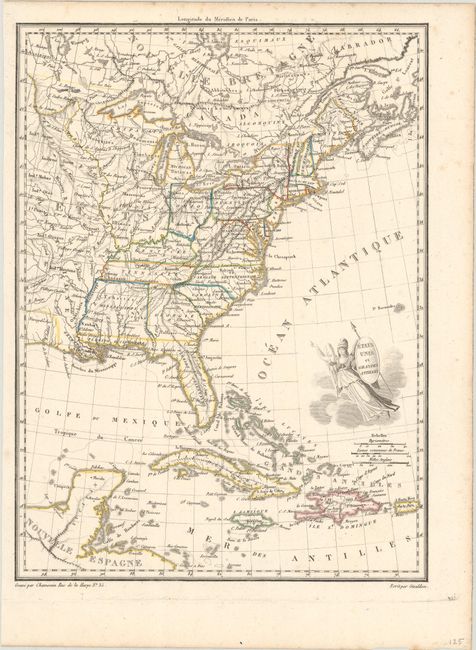
This early nineteenth-century map shows the United States with the recent Louisiana Purchase. There is a large Mississippi Territory that includes present-day Alabama, and Florida is still shown divided into West and East, which incorporates an errouneous mountain range stretching from the Appalachian Mountains down to the full length of Florida. The region between the upper Mississippi and the Ohio River is unorganized. The map extends to include Cuba, Jamaica, Haiti, and Puerto Rico. The title is engraved on the shield of a female representation of Columbia. Lettering by Giraldon.
References:
Condition: A
Contemporary outline color with a few faint spots of foxing in the top of the image.