Subject: North America
Period: 1845 (circa)
Publication: Atlas Universel Illustre
Color: Hand Color
Size:
16.6 x 10.9 inches
42.2 x 27.7 cm
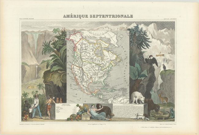
Victor Levasseur's "Atlas National Illustre" and "Atlas Universel Illustre" are among the last decorative atlases published. The maps are all lavishly illustrated with scenes of the countryside, products and activities indigenous to the region.
This early version of Levasseur's decorative map of North America shows Mexico in control of Texas and the Southwest with Mexico's northern border drawn according to the Treaty of 1819 (here misprinted as 1810). The United State's claims into present-day British Columbia reflect James Polk's expansionist policies. The map is surrounded by beautifully engraved scenes of North and Central America including local animals, a ship stranded in the polar sea, and a Mayan temple.
References:
Condition: A
Attractive color on a clean sheet with a hint of toning along the sheet edges.