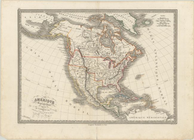
Subject: North America
Period: 1835 (circa)
Publication: Depot de la Guerre
Color: Hand Color
Size:
14.9 x 10.7 inches
37.8 x 27.2 cm
This uncommon copper-engraved map portrays the United States extending well into British Columbia, demonstrating the Fifty-four Forty or Fight controversy and cartographically taking the side of the United States. The Rocky Mountains are called the Montagues Rochieuses. The Great Salt Lake is called Lake Timpanogos with the smaller Lake Teguya below. Several river systems cross the Great Basin area. Alaska is Russie Americaine, and all of Canada is Nouvelle Bretagne. Fancy titling with flourishes and a keyboard-style border embellish the map. This is an early edition of this map, prior to the addition of Texas as a Republic. Engraved by Lale.
References:
Condition: A
On a mostly clean watermarked sheet with a short centerfold separation confined to the bottom blank margin that has been closed on verso with archival tape.