Catalog Archive
Auction 184, Lot 97

"Carta dell' America che Serve d'Illustrazione al Nuovo Dizionario Geografico Universale Stat. Stor. Comm. Etc.", Antonelli, Guiseppe

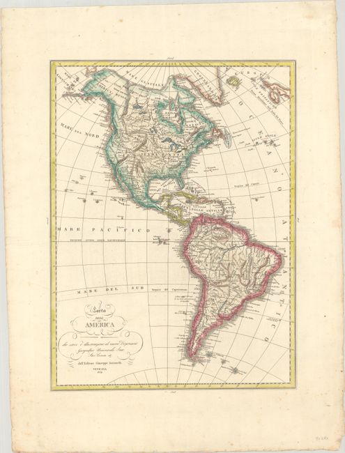
Subject: Western Hemisphere - America

Period: 1834 (dated)

Publication:

Color: Hand Color

Size:
13.7 x 18.4 inches
34.8 x 46.7 cm
Download High Resolution Image
(or just click on image to launch the Zoom viewer)

This attractive Italian map of the Americas is engraved with fine topographical detail and filled with place names. In North America, Alaska is still a bit misshapen with the interior unexplored. The United States' northern boundary extends into present-day British Columbia reflecting American interests in the region. In the Great Basin, a speculative S. Filippo River extends from Lake Timpanogos to the Pacific Ocean. The islands in both the Atlantic and Pacific are well delineated, and the course of the Amazon River dominates northern South America.

References:

Condition: A

A crisp impression on watermarked paper with some minor foxing in the margins.

Estimate: $200 - $230

Sold for: $100

Closed on 9/15/2021

Archived