Subject: Western Hemisphere - America
Period: 1719 (circa)
Publication: Atlas Historique
Color: Black & White
Size:
17.1 x 13 inches
43.4 x 33 cm
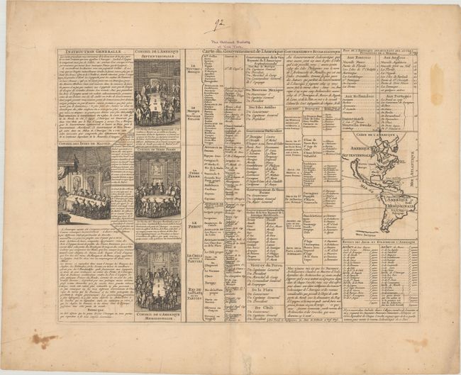
A folio sheet filled with fascinating French text, statistics and four engravings showing the Council of the Indies dividing up the Spanish Empire in America. The map itself (3.7 x 5.2") shows an unnamed island of California on the Sanson model. The only political detail is the division of the regions between the colonial powers. Far to the south, a purely speculative Antarctic continent is suggested as Terre Inconnue.
References: McLaughlin #164.
Condition: B
On watermarked paper with light offsetting, a few small stains, and a couple of edge tears that have been closed with hinge tape on verso. There is an ownership inscription above the top border.