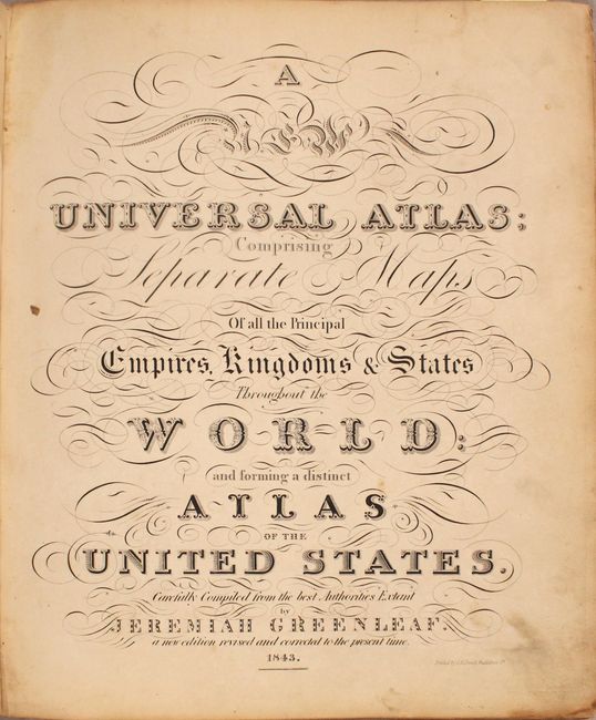
Subject: Atlases
Period: 1843 (published)
Publication:
Color: Hand Color
Size:
12.4 x 14.7 inches
31.5 x 37.3 cm
This important and complete atlas is the third edition of Greenleaf's atlas, which was a reissue of David Burr's 1836 edition of A New Universal Atlas. Small changes were made throughout, including the removal of Burr's imprint and the copyright notice, as well as the addition of new railroads and counties. Greenleaf also added two new maps, Texas and Wisconsin and Iowa, which underwent several iterations through the various editions of Greenleaf's atlas.
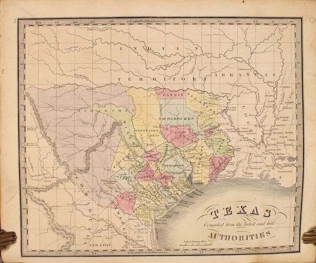
The map of Texas features an independent Republic of Texas. The map is based upon Burr’s map of 1833, which was the first to show the territorial claims that would eventually become the Republic. Greenleaf's map depicts conservative boundaries, with the boundary between Texas and Mexico along the Nueces River instead of the Rio Grande, and the northern boundary along the Red River rather than the Arkansas River. Although this map does not extend to include the panhandle, it is one of the earliest to delineate Texas counties rather than the empressario grants. Counties are up to date for 1838, with the newly organized Fannin and Galveston, but just prior to the organization of Harrison. Development is confined to areas to the east of San Antonio and Austin, with the areas to the west void of detail except for the river system and the locations of a few Indian tribes. Portions of Indian Territory, Arkansas and Louisiana are also shown.
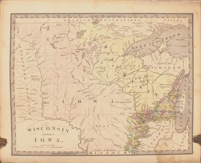
The map of Wisconsin and Iowa extends from Missouri Territory (just west of the Missouri River) to Lake Michigan, and as far south as the northern border of the state of Missouri. The map was published just a few years before Iowa was admitted as a state, and county development is confined along the Mississippi River and Lake Michigan. Outside of the developed areas, numerous Indian tribes are located, including the Chippeways, New York Indians, and Iowas, and the river system is depicted in good detail. A large, triangular Carvers Tract is shown in present-day eastern Minnesota and northwestern Wisconsin. Heirs of Jonathan Carver, who is known for his explorations in the area, contended that the Sioux Indians had signed a deed granting Carver 10,000 square miles of land. The descendants petitioned the U.S. Congress for legal rights to the land, but Congress determined in 1823 that the deed had never existed. Regardless, unscrupulous descendants and agents continued to sell portions of "Carver's Grant" for decades.
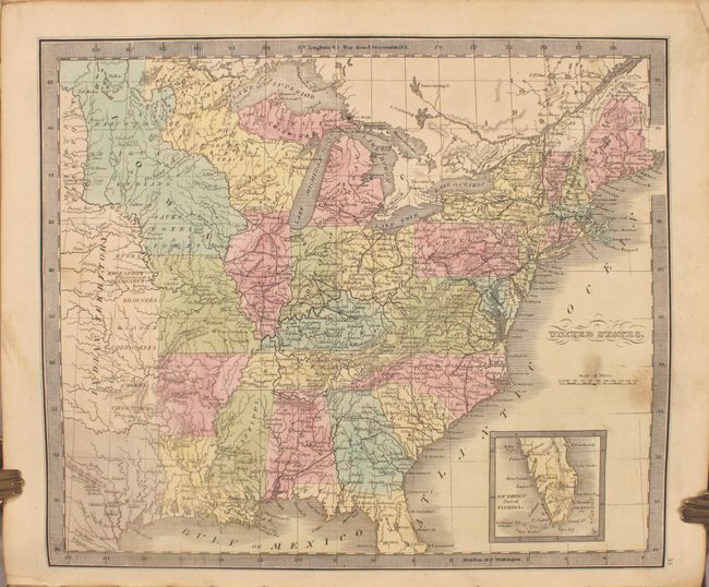
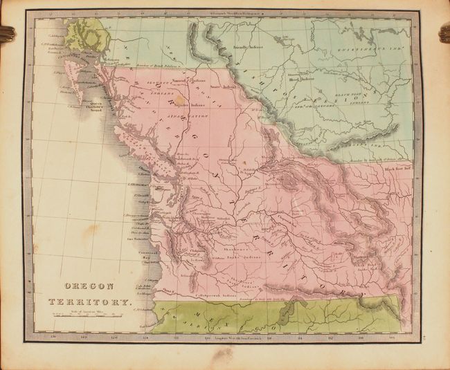
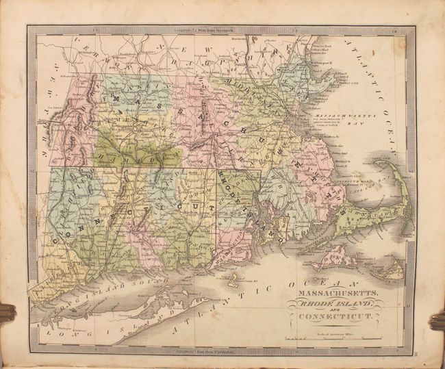
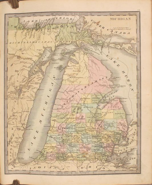
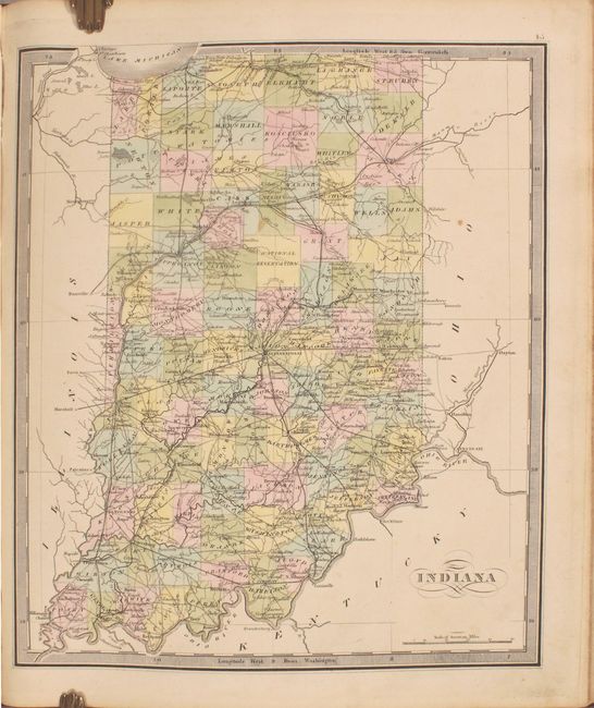
The atlas contains a total of 65 maps covering the world and continents with 38 maps relating to the Americas and 26 specific to the United States. Cartographically, the map of the United States shows the western frontier consisting of Missouri Territory, Indian Territory, Iowa Territory, and the Republic of Texas. In the north, the large Carver's Tract is also delineated in present-day Wisconsin. The atlas features an early map dedicated to Oregon Territory that encompasses present-day Washington and extends well north into British Columbia, reflecting U.S. interests in the region. Additionally, there are numerous state maps showing early county development including Michigan, Illinois, Indiana, Missouri, and Mississippi to name a few. Accompanying the map of New York state is the Map of the Country Twenty Five Miles Round the City of New-York. There are 11 pages of text at the end with a brief description of each continent and statistical details on the key cities of the world. Folio, hardbound in new quarter leather with tips over original black cloth boards with original red leather title label on the front cover; marbled endpapers.
References: Phillips (A) #784; cf. Rumsey #4850 (1840 edition).
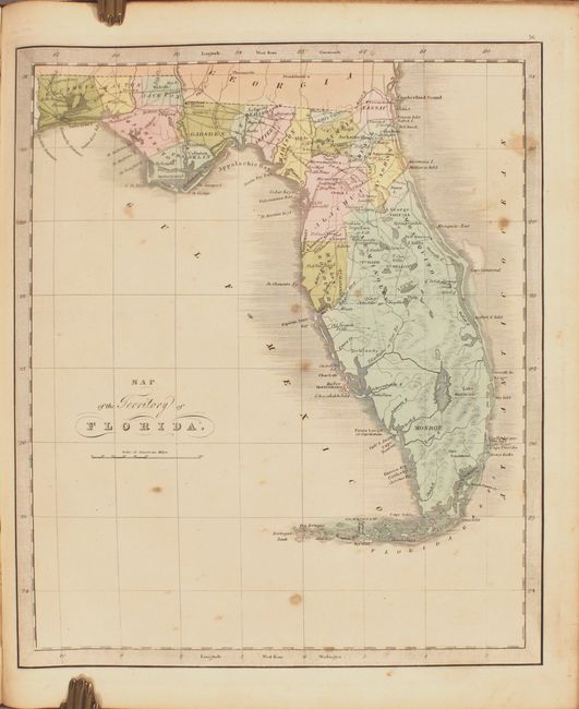
Condition: B+
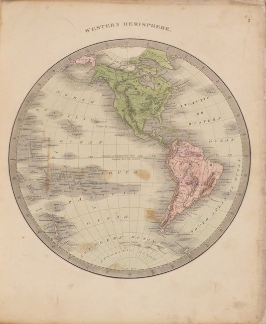
The maps have nice impressions and are in full contemporary color with occasional light soiling and minor toning. Many of the maps are in "A" condition. Four maps are in "B" condition with a bit more soiling or foxing (western hemisphere, Louisiana, Florida, and West Indies). The maps of the western hemisphere and Wisconsin have archivally repaired chips along the fore-edge. There are significant pencil scribbles on the verso of the map of North America that don't affect the map image. There is a dampstain affecting the bottom edge of the end of the volume, affecting the 11 pages of text, the back free-endpapers, and to a lesser extent the maps of Texas and Wisconsin. The title page and front free-endpapers also have dampstains along the gutter. The front covers have some professionally repaired chips (including a very large one on verso) and the new spine and tips show light wear.