Subject: Atlases
Period: 1820 (published)
Publication:
Color: Hand Color
Size:
12.3 x 17.8 inches
31.2 x 45.2 cm
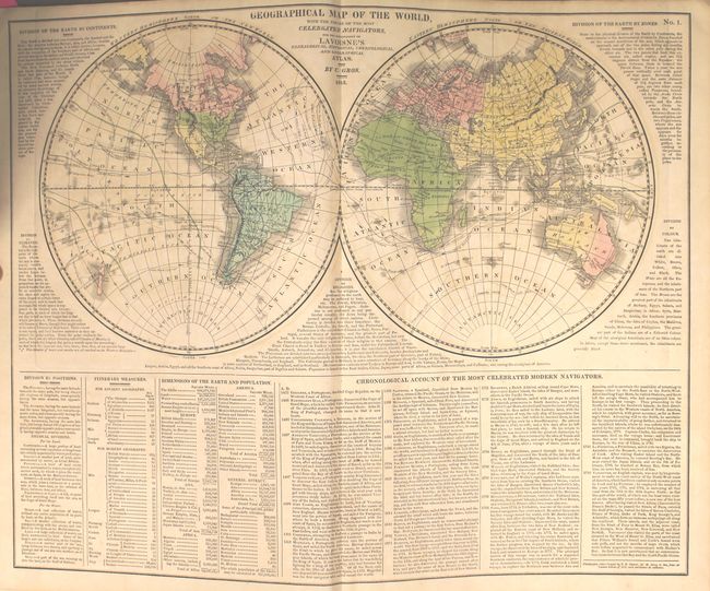
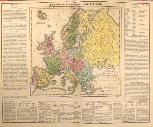
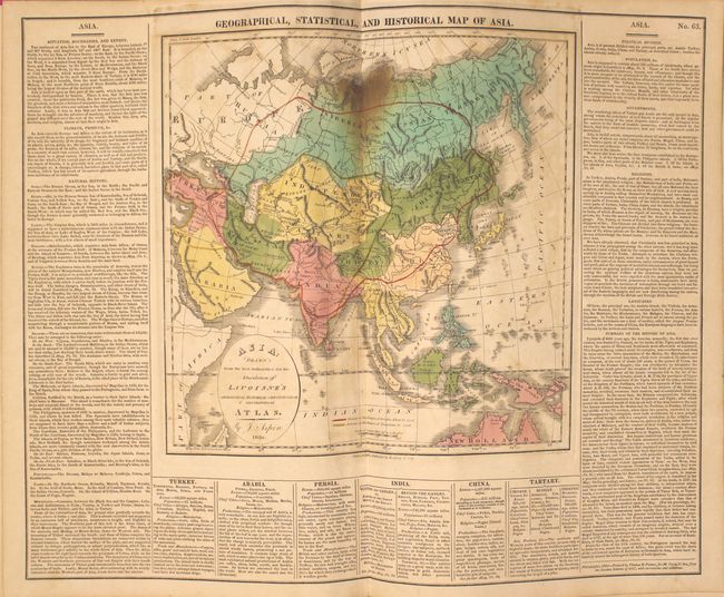
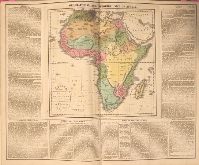
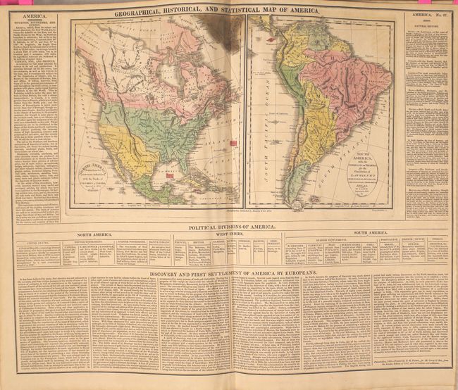
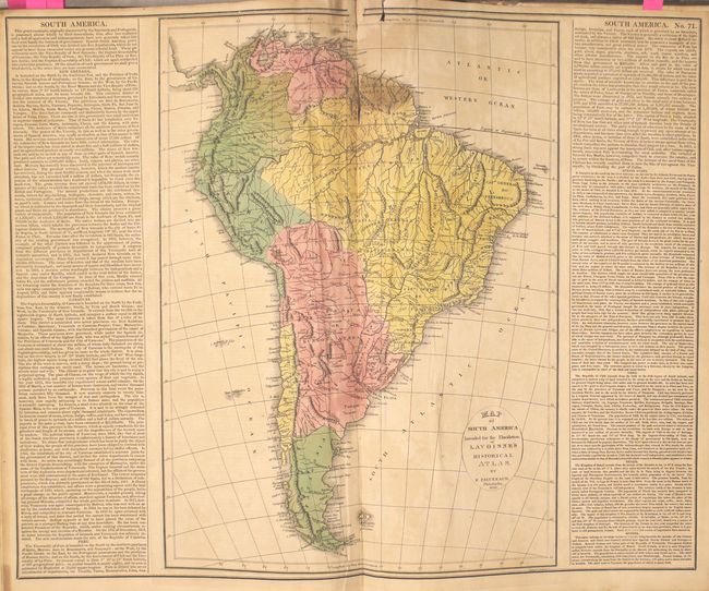
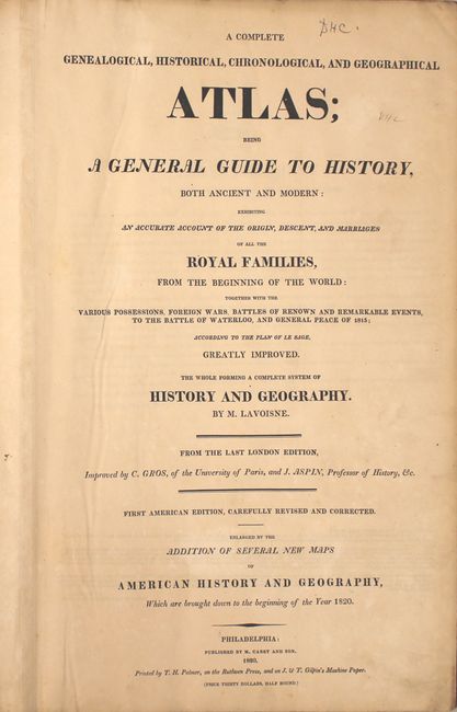
This is Lavoisne's second American edition folio atlas "carefully revised and corrected" by C. Gros and J. Aspin. Published by M. Carey and Sons, and printed by T.H. Palmer "on the Ruthven Press, and on J. & T. Gilpin's Machine Paper." The atlas is complete and contains 28 double-page maps, plus scores of detailed and colorful tables, chronological and historical, on 71 plates. The maps are listed below.
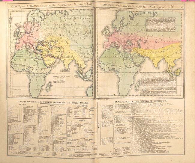
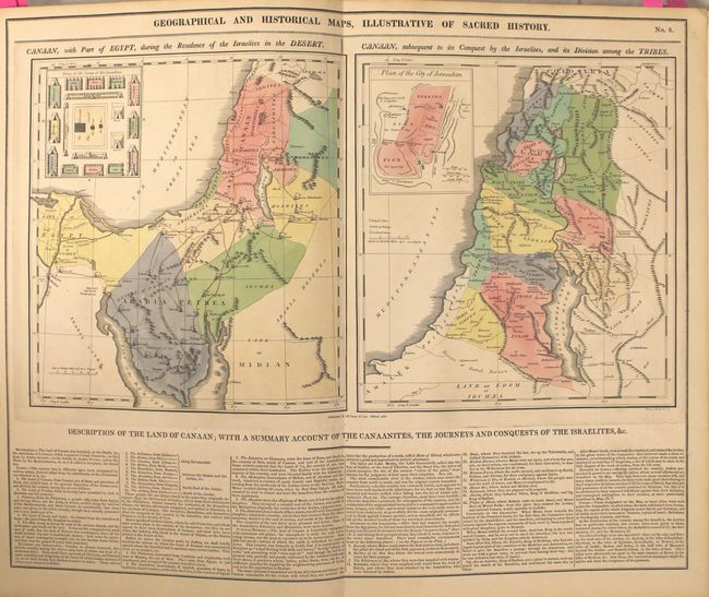
World in hemispheres; Ancient World; Ancient World of Noah; Canaan & Egypt (two single-page maps); Ancient Greece; Roman Empire; Incursion of the Barbarians; Europe 1820; England, Scotland & Ireland; England & Wales; Scotland; Ireland; France; France…Treaty of 1815 with Netherlands, Switzerland and part of Italy; Spain & Portugal; Germany; Kingdom of Netherlands; Italy; Poland; Russia; Denmark (single page); Sweden (single page); Turkey in Europe (single page); Turkey in Asia (single page); Asia; China; Hindoostan or India; Africa; North America (single page); South America with the Conquests of Pizarro (single page); United States; and South America.
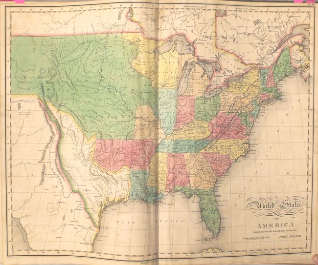
The United States map, by John Melish, provides a detailed view of the Missouri River and the headwaters of the Columbia River based on information from Lewis and Clark's expedition. The new state of Missouri is shown with a straight western border. Michigan Territory includes the eastern part of present-day Wisconsin, which is still a part of the North West Territory. The large Arkansas Territory takes in most of present-day Oklahoma. Texas is a part of Mexico. One of the most interesting features of the map is the river system in the West, near the Highest Peak, where the headwaters of several major rivers all originate within a few miles of one another - Red River of California (Colorado), Multnomah (Willamette), Rio del Norte (Rio Grande), Arkansaw (Arkansas), and the Platte.
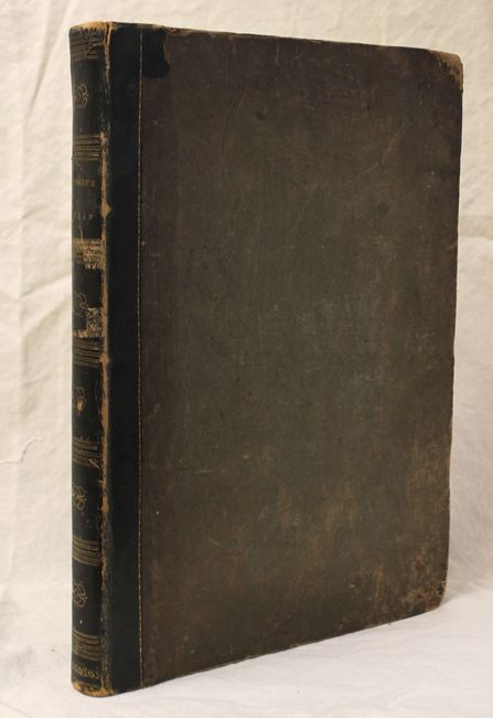
Hardbound in quarter calf and tips over olive boards. Title page, introduction, contents, maps and tables. The bookplate states "This book belonged to the library of Anson Phelps Stokes, Esq. 1838-1913 of New York City, a merchant, banker, publicist, and multimillionaire, and on his beath became the propoerty of Rev. Anson Phelps Stokes."
References:
Condition: B+
Overall maps are in good to near fine condition in contemporary color, with light toning and offsetting. A few of the maps, most notably the Americas, Asia and India, have a small area of color oxidation near the gutter (with the Americas map having a few resultant cracks that have been repaired on verso with archival materials). The map of South America has a short centerfold separation and edge tears resulting in minute loss of image. Covers are moderately stained and worn and the hinges are starting. A previous owner’s pastedown is located on the inside front cover with ex-library stamps on the verso of the title page.