Subject: New Zealand
Period: 1938 (circa)
Publication:
Color: Printed Color
Size:
19.1 x 29.1 inches
48.5 x 73.9 cm
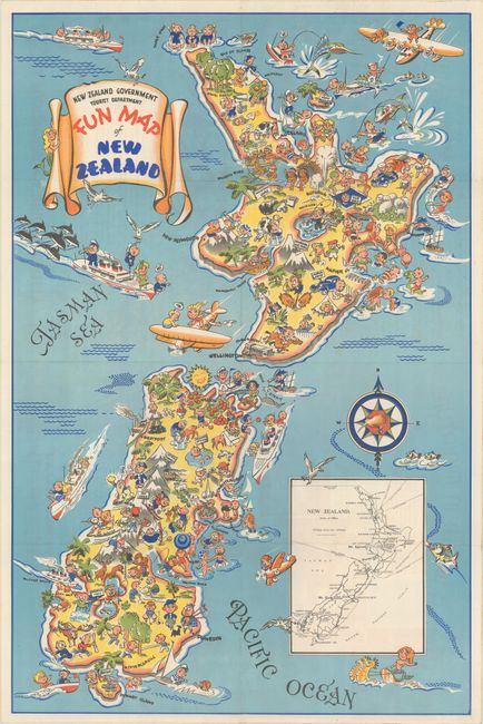
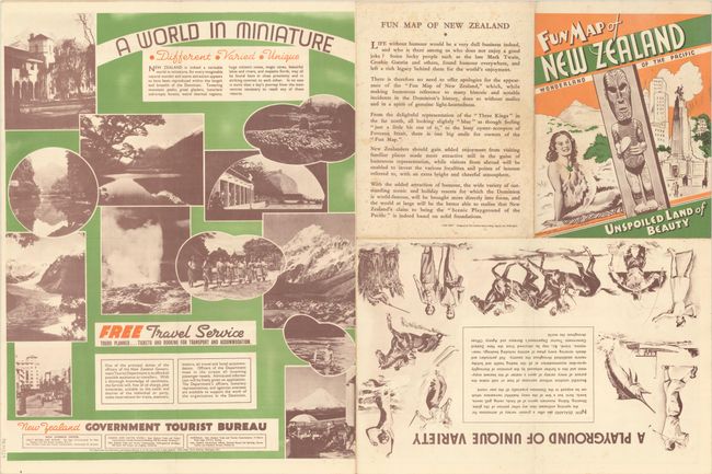
This whimsical map of New Zealand is reminiscent of Ruth Taylor White's pictorial maps, with cartoonish characters engaged in every possible activity on the North and South Islands. Important sites and historical events are also depicted, including the signing of the Treaty of Waitangi and Captain Cook aboard a galleon sighting the islands. Text on verso assures that every "humorous reference" on the map was done "without malice and in the spirit of genuine light-heartedness." Designed by the Charles Haines Advertising Agency, the oldest such agency in New Zealand and still in operation today. The map was published by the New Zealand Government Tourist Department and includes an inset with a basic (and more accurate) map of the country. On verso is additional information on New Zealand and a message encouraging travelers to book their trips through the Tourist Department.
References:
Condition: A
A clean and bright example, issued folding with a few tiny holes at fold intersections.