Subject: Australia
Period: 1860 (circa)
Publication: Black's General Atlas
Color: Hand Color
Size:
21.8 x 16.3 inches
55.4 x 41.4 cm
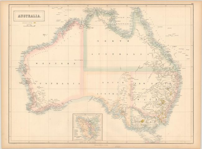
This handsome atlas map of Australia prominently displays the gold regions, which were first publicized by the Australian government only a few years prior. It divides Australia into Western Australia, Northern Territory, South Australia, New South Wales, and Victoria; Queensland has not yet been established. Van Diemen's Land (Tasmania) appears in an inset at bottom with a key identifying its political divisions. Much of the interior is blank, but in New South Wales and Victoria and around the coasts, there is good detail of towns and cities, roads, rivers, and mountains. Constructed and engraved by J. Bartholomew.
References: Tooley (Australia) #181.
Condition: A
There is some minor toning along the sheet edges.