Subject: Northern Africa
Period: 1834-46 (circa)
Publication:
Color: Hand Color
Size:
15.5 x 12.3 inches
39.4 x 31.2 cm
The beginning of the nineteenth century saw a period of rapid market growth and innovation in the map publishing world. Increased literacy and public interest in new frontiers and colonies overwhelmed the market because it was oriented toward the small, affluent market of the previous century. With the intent to fill this void, The Society for the Diffusion of Useful Knowledge (SDUK) was founded in 1828 in London, by Lord Brougham and a group of men dedicated to the education of the aspiring working class and the Utilitarian ideal of 'Knowledge is Power.' The society produced an array of education materials, but the series of maps was one of their most successful ventures. A number of engravers and printers were used to produce the maps, which eventually exceed 200 sheets, and continued to be published after the Society as a whole ceased to function.
This fine set of steel engraved maps covers the region from Morocco east to Tripoli and Western Egypt. All follow the coast and are filled with fascinating information and details. Keyboard style borders. All were engraved by J. & C. Walker. Published by Baldwin & Cradock, unless indicated otherwise below.
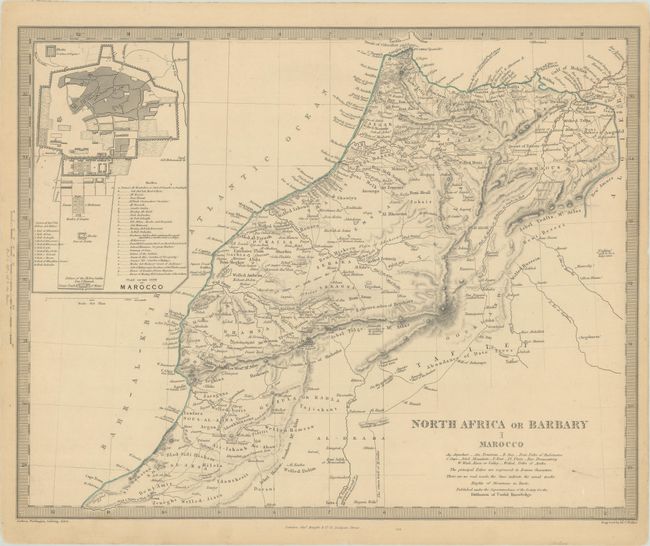
A. North Africa or Barbary I Marocco, circa 1846. This map includes a large and detailed inset plan of the walled city of Morocco (Marrakech) that locates eleven gates and twenty-six mosques. Published by Charles Knight & Co. Condition: Marginal toning with a hint of soiling. (A)
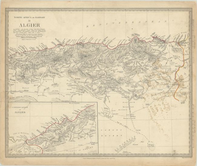
B. North Africa or Barbary II Algier, dated 1834. This map shows detail of the Mediterranean coast and includes a continuation of Algiers in an inset. Condition: There are scattered stains and light soiling. (B)
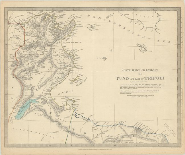
C. North Africa or Barbary III Tunis and Part of Tripoli, dated 1836. Centered on the Golphe de Gabes, this map details a portion of Tunisia, Algeria, and Libya. A French Coral Fishery is noted at upper left. Condition: There is minor scattered foxing that is mostly confined to the blank margins. (A)
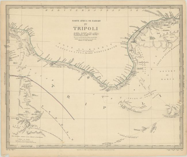
D. North Africa or Barbary IV Tripoli, dated 1837. This map focuses on the area around Libya's Gulf of Sidra, here also noted as Gulf of Sulphur. Caravan routes are traced in the interior with interesting notations concerning the wildlife and inhabitants of the region, e.g., "Desert Plain of Gravel with scattered carcasses of Animals dried by the sun." Condition: There are a couple short edge tears in the bottom blank margin and light soiling, most of it confined to the margins. (A)
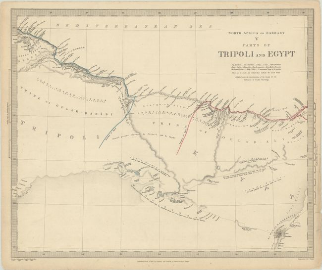
E. North Africa or Barbary V Parts of Tripoli and Egypt, dated 1837. This map describes the border area between Libya and Egypt on the Mediterranean, including a buffer zone noted as "Neutral ground claimed by Tripoli and by Egypt." Condition: There is minor soiling and a few edge tears in the blank margins. (A)
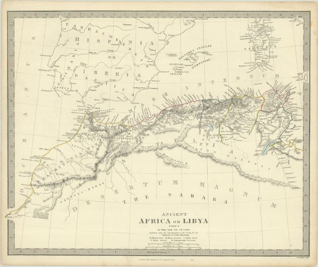
F. Ancient Africa or Libya Part I, circa 1844. This map covers the coastal regions of present-day Morocco, Algeria, and Tunisia. It extends to include part of the Iberian Peninsula, the Balearic Islands, and Sardinia. There are many ancient place names. cities, villages, harbors, and rivers. Published by Charles Knight & Co. Condition: There is a small rust spot and a light dampstain enters the border at top right. (B+)
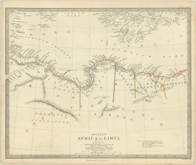
G. Ancient Africa or Libya Part II, circa 1844. The second part of the above map extends to include the coast of Libya and western Egypt to the Nile. Published by Charles Knight & Co. Condition: There are a few small spots and a light dampstain enters the border at top right. (B+)
References:
Condition:
See description above.