Subject: Africa
Period: 1720-62 (circa)
Publication:
Color: Hand Color
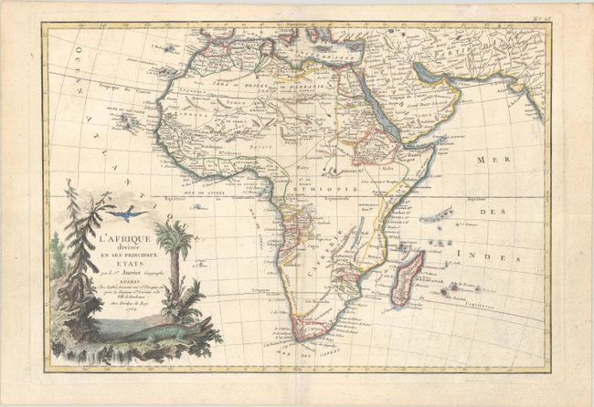
A. L'Afrique Divisee en ses Principaux Etats, by Janvier/Lattre, from Atlas Moderne, dated 1762 (17.1 x 11.8"). This excellent copper engraved map of the continent shows the extent of European geographical knowledge in the mid 18th century. While mostly accurate, it does have remnants of fantasy such as the twin lake source of the Nile in the Mts de la Lune, which in this depiction is quite a bit north of the Equator. C. de Bonne Esperance and Stellembos Pic are the only settlements marked in southern Africa, which is occupied by the Hottentots tribes. The pictorial title cartouche features a waterfall, pine trees, a leopard, and a crocodile. The map likely appeared in Atlas Moderne. Reference: Norwich #104. Condition: Contemporary outline color with later color in the cartouche, on watermarked paper with light soiling.
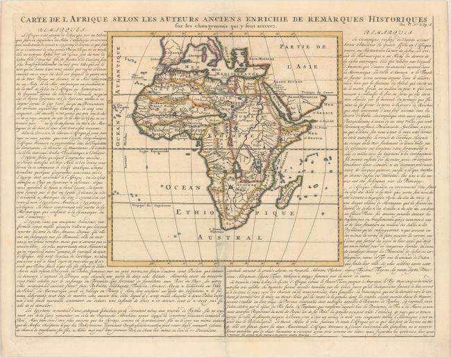
B. Carte de l Afrique Selon les Auteurs Anciens Enrichie de Remarques Historiques..., by Henry Abraham Chatelain, from Atlas Historique, circa 1720 (19.0 x 14.6"). This nicely engraved map of the continent mostly conforms to the geography typical of the late 17th century but shows places as known to the ancients. The Nile appears according to the ancient pattern, arising from two large lakes complete with large islands. Panels of French text surround the map on three sides. Condition: A dark impression on a sheet with a Strasburg Bend & Lily watermark, minor soiling, and a 6" tear at bottom that has been archivally repaired.
References:
Condition: B+
See description above.