Subject: Madagascar
Period: 1794 (dated)
Publication:
Color: Black & White
Size:
17.1 x 22.8 inches
43.4 x 57.9 cm
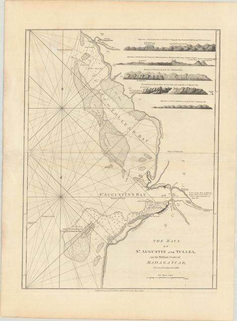
This very uncommon nautical chart centers on the Bay of Toliara and the Bay of Saint Augustin along the southwestern coast of Madagascar. The ocean is crisscrossed with rhumblines and is filled with excellent navigational information, including soundings, anchorages, bottoms, reefs, and banks. Along the coastline, there is some topographical detail, with notes indicating "Steep Cliffs close to the Sea," "Low Land covered with Trees," and more. The mouth of the Dartmouth River (Onilahy River) is depicted. There are five coastal profile views at top right.
References:
Condition: B+
On a sheet with a large Strasbourg Lily watermark, light offsetting, some minor dampstaining, and a few tears along the centerfold that have been archivally repaired.