Catalog Archive
Auction 184, Lot 701

"Carte de l'Ocean Oriental ou Mer des Indes pour Servir a l'Histoire Generale des Voyages", Bellin, Jacques Nicolas

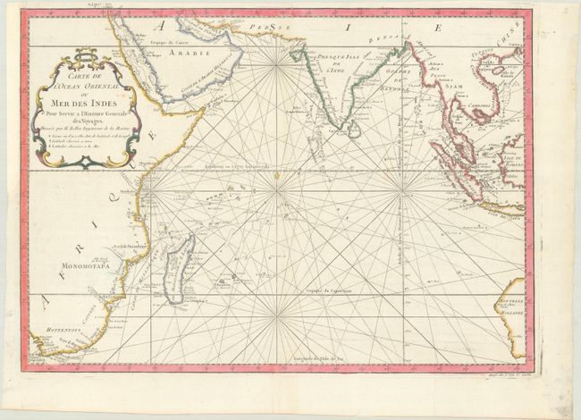
Subject: Indian Ocean

Period: 1760 (circa)

Publication: Histoire Generale des Voyages

Color: Hand Color

Size:
19 x 13.5 inches
48.3 x 34.3 cm
Download High Resolution Image
(or just click on image to launch the Zoom viewer)

This chart covering from South Africa through to Western Australia was reduced from Bellin's large-scale chart of the region and provides great detail of the islands and coastlines. The locations where latitude and longitude were measured, both on land and at sea, are noted throughout the map. Rhumb lines, fleur-de-lys, and a delicate title cartouche make this a very attractive sheet.

References:

Condition: A

A bright sheet with a bunch of grapes watermark, issued folding and now flattened, with a binding trim at left that has been replaced with old paper.

Estimate: $240 - $300

Sold for: $160

Closed on 9/15/2021

Archived