Subject: Southern Asia
Period: 1642 (published)
Publication: Aenhangsel van 't I en II Deel van 't Toonneel des Aerdryks, of Nieuwe Atlas
Color: Hand Color
Size:
20.6 x 16.4 inches
52.3 x 41.7 cm
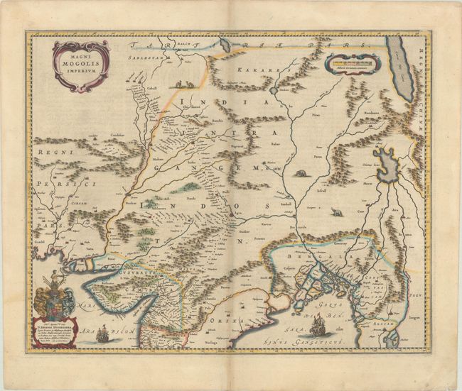
This map depicts the Empire of the Great Moghul in northern India, including the region from Iran to Burma (Myanmar). The important travel route from Kabul to Surat is the most prominent feature of the map. This was the route traveled by the embassy of the Englishman Sir Thomas Roe to the Moghul emperor Jahangir in 1615, as derived from a map published by William Baffin in London in 1618. This Dutch version of Baffin's map remained the standard Dutch view of the region throughout the seventeenth century. Finely decorated with strapwork title and scale of miles cartouches, a dedication to Johannes Huydekoper with coat of arms, sailing ships, elephants and camels. Dutch text on verso.
References: Van der Krogt (Vol. II) #8330:2.
Condition: B+
A nice impression with light soiling, some show-through of text on verso, and a short centerfold separation in the bottom blank margin. There is a shadow along the centerfold that is caused by our scanner and doesn't appear on the map itself.