Catalog Archive
Auction 184, Lot 690

"Nouvelle Carte de l'Isle de Java, Dressee Suivant les Observations les Plus Recentes, Faites par Ordre de la Comp. Holl. des Indes Orientales", Bellin/Van Schley

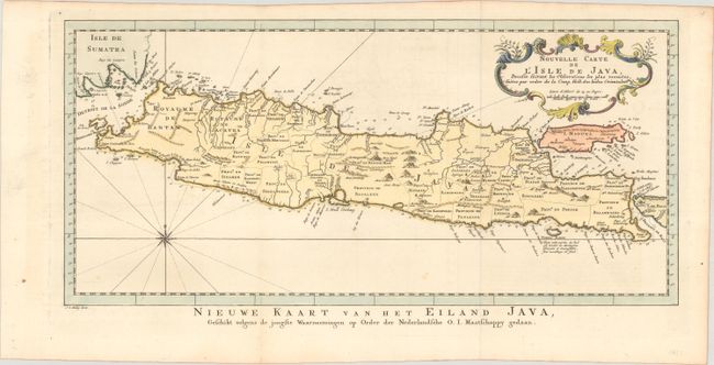
Subject: Java, Indonesia

Period: 1773 (circa)

Publication: Raynal's Atlas Portatif

Color: Hand Color

Size:
17.3 x 8 inches
43.9 x 20.3 cm
Download High Resolution Image
(or just click on image to launch the Zoom viewer)

Attractive chart of the island depicting soundings around the coast, all principal harbors, rivers and elevations, bays and points, settlements and provinces. Included are Madura, Bali, Sunda Strait and the southeastern tip of Sumatra. The island is divided into provinces and the kingdoms of Bantam, Tsieribon and Jacatra. A nice compass rose and decorative title cartouche complete the map. Titled in Dutch below the map: Nieuwe Kaart van het Eiland Java...

References:

Condition: A

A crisp impression on a bright sheet of watermarked paper, issued folding with faint offsetting and a couple of minor spots at bottom.

Estimate: $180 - $210

Sold for: $160

Closed on 9/15/2021

Archived