Subject: Northern Asia
Period: 1685 (circa)
Publication:
Color: Hand Color
Size:
21.6 x 17.1 inches
54.9 x 43.4 cm
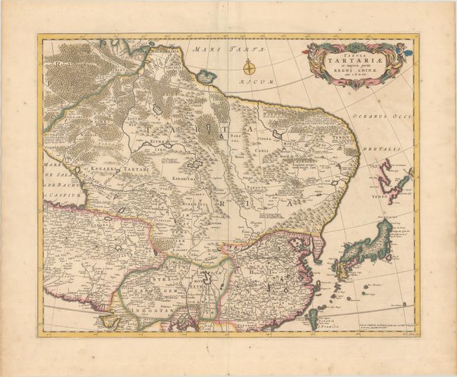
Fine map of the region from the Caspian Sea through China and Japan. Eastern Russia is truncated with no Kamchatka peninsula and Yedso is shown according to the voyages of De Vries. The Great Wall is prominently shown separating China from the interior deserts. The mythical Chiammay Lacus is shown with its five major rivers. A strapwork title cartouche with two putti and a compass rose ornament the chart. Engraved by Lhuilier.
References:
Condition: A
A crisp impression with full contemporary color on a bright sheet with a crease adjacent to the centerfold, a few tiny spots, and an archivally repaired centerfold separation in the top blank margin.