Subject: Asia
Period: 1729 (circa)
Publication: Introductio in Universam Geographiam
Color: Hand Color
Size:
10.2 x 8.3 inches
25.9 x 21.1 cm
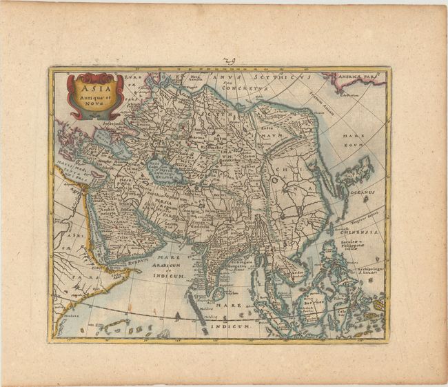
Attractive copper engraved map of the continent extends to include Japan, the Philippines, and all of the East Indies (Indonesia). North America is shown at extreme upper right, labeled Americae Pars. The outline of Asia follows the Mercator-Hondius model with the Arctic and extreme northeast coastlines truncated, an elongated Korean Peninsula, and a narrow Indian Peninsula. There are numerous place names except in China, which is strikingly void of any names and instead filled with a bold network of rivers and large lakes. The mythical Lake Chiamay appears unnamed in western China with five rivers flowing south. This is a later issue of the map with some slightly different place names, a strapwork cartouche, and no engraver's imprint.
Cluver's Introductio in Universam Geographicam was a popular atlas, appearing in over 45 editions during a 100-year period. The first edition was published without maps in the 1620s, and the first edition to include maps was published circa 1641. The various editions were published in different cities throughout Europe, including Amsterdam, Nuremberg, and London.
References: Yeo #29.
Condition: A
A dark impression on paper with a coat of arms watermark, a few minor spots, and light printer's ink residue.