Subject: Persia - Iran
Period: 1749-83 (circa)
Publication:
Color: Hand Color
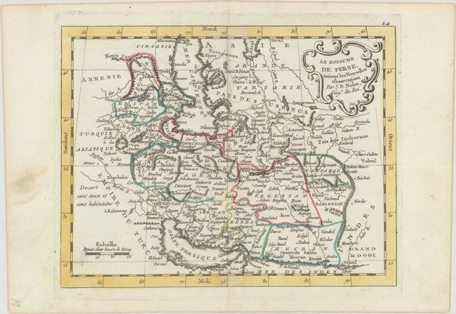
A. Le Royaume de Perse, Suivant les Nouvelles Observations, by J.B. Nolin, circa 1783 (10.3 x 7.9"). This small French map shows Persia with political divisions, towns and cities, and nice topographical detail. The Arabian Desert is labeled Desert sans eaux et sans habitations ("Desert without water and without homes"). There is a rococo-style title cartouche at top right. Condition: A crisp impression with a touch of soiling along the centerfold at top. (A)
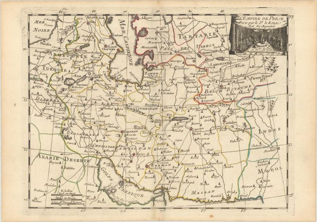
B. L'Empire de Perse, by George Louis Le Rouge, from Atlas Nouveau Portatif..., circa 1756 (11.1 x 8.3"). This nicely engraved map of Persia features political divisions, towns and cities, roads, and some topographical detail. The decorative title cartouche at top right presents the Shah and his courtiers. Condition: A sharp impression on watermarked paper with minor soiling, a touch of color offsetting, and a 1.25" centerfold separation at bottom that has been closed on verso with archival materials. (B+)
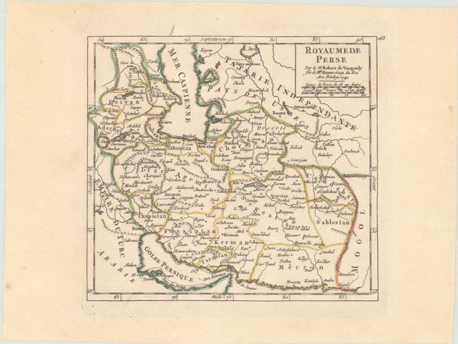
C. Royaume de Perse, by Didier Robert de Vaugondy, from Atlas Portatif, dated 1749 (7.0 x 6.4"). This handsome map spans from Baghdad (here located outside the border of Irac) east to Balkh and Kandahar. There are plenty of place names and topographical details for a map of its size. The simple title cartouche at top right also encloses two distance scales. Condition: A fine impression on watermarked paper. (A)
References:
Condition:
See description above.