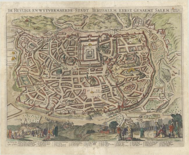
Subject: Jerusalem, Holy Land
Period: 1646 (circa)
Publication:
Color: Hand Color
Size:
16.8 x 12.3 inches
42.7 x 31.2 cm
This detailed bird's-eye plan was one of the most popular plans of Jerusalem during the seventeenth century. While it is imaginary, it provides great detail of the city walls and streets, with 36 principal sites numbered and keyed to a table at bottom. Solomon's Temple is at upper center and Herod's Palace is located at the far left. Biblical scenes are shown on the hillsides in the foreground. Dutch text on verso.
Danckerts copied this map from Claes Janszoon Visscher's earlier map from 1642, as the two families were fierce competitors in the mid-seventeenth century, both of whom had their businesses located on the same street in Amsterdam. Danckerts' edition of this map is quite rare.
References: Poortman & Augusteijn #104.
Condition: A
A nice impression on a bright sheet with some printer's ink residue. There are professional repairs to some minor separations along the centerfold and to two short edge tears.