Subject: Holy Land
Period: 1720 (circa)
Publication: Atlas Historique
Color: Black & White
Size:
18.8 x 15.3 inches
47.8 x 38.9 cm
A nice set of Holy Land maps from Chatelain's Atlas Historique including:
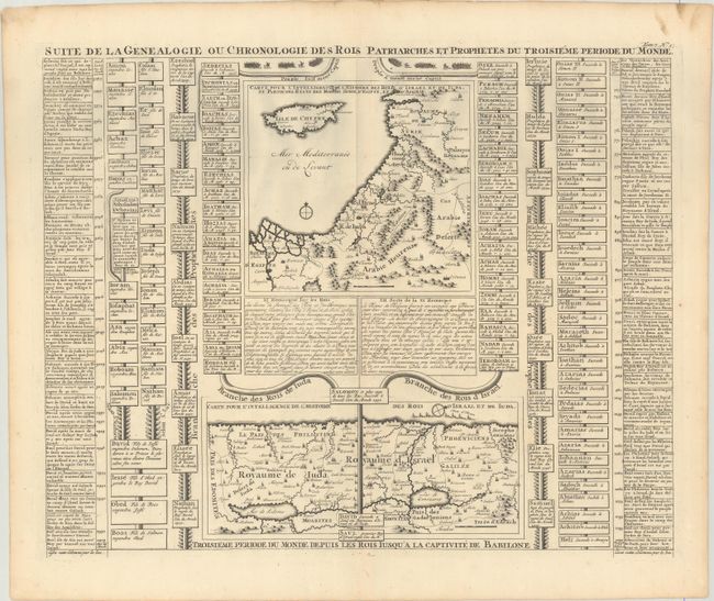
A. Suite de la Genealogie ou Chronologie des Rois Patriarches et Prophetes du Troisieme Periode du Monde. This fascinating folio sheet contains two maps of the Holy Land with text and family trees describing the region during Biblical times. The upper map shows the region from Alexandrie and Antioche in present-day Syria to the Nile Delta and includes Cyprus and part of the Arabian desert. The bottom map focuses on Palestine with north oriented to the right.
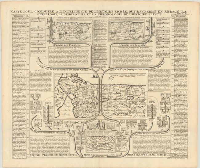
B. Carte pour Conduire a l'Inteligence de l'Histoire Sacree, qui Renferme en Abrege la Genealogie, la Geographie, et la Chronologie de l'Histoire Sainte. This interesting sheet contains four maps that illustrate the biblical history of the Holy Land. The main map at center (Carte de l'introduction du peuple d'Israel dans les Pais de Canaan) shows the region after the distribution of the Tribes of Israel. Two smaller maps at the top are designed for the understanding of the Book of Judges, and the government of David and Salomon. A small map at bottom shows Canaan before the destruction of Sodom. All the maps are surrounded by genealogical and geographical information.
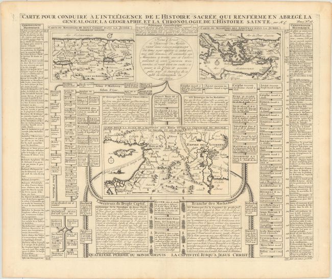
C. Carte pour Conduire a l'Inteligence de l'Histoire Sacree, qui Renferme en Abrege, la Genealogie, la Geographie, et la Chronologie, de l'Histoire Sainte. This intriguing sheet features three maps of the Holy Land with text and family trees describing the region during biblical times. At upper left a map of Palestine is divided into Galilee, Samaria, and Judea as traveled through by Jesus Christ. At upper right a map of the Eastern Mediterranean illustrates the travels of the Apostles. At center is a map of the Middle East for the understanding of the history of the Kings. The balance of the sheet is comprised of genealogical diagrams and historical text.
References: Laor #210, 211, & 212.
Condition: A
Crisp impressions on bright sheets with a few minor imperfections confined to the top blank margins.