Subject: Holy Land
Period: 1584 (published)
Publication: Theatrum Orbis Terrarum
Color: Hand Color
Size:
19.7 x 14.5 inches
50 x 36.8 cm
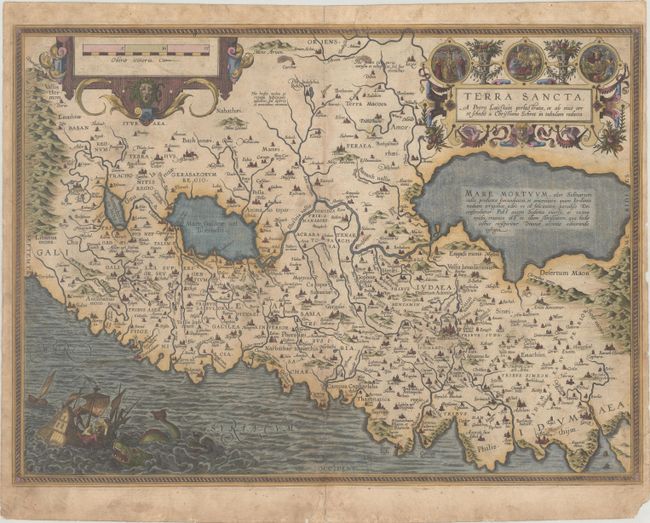
This striking map is considered the most 'modern' of Ortelius' maps of the Holy Land. It is a very detailed map, centered on Samaria, with north oriented to the left. The map was drawn by Christian Schrot with cartography based on Peter Laicksteen's wall map describing his 1566 visit to the Holy Land. The elaborate title cartouche incorporates vignettes of the birth, crucifixion, and resurrection of Jesus. The map is further adorned with a bold distance scale featuring the head of Medusa and a dramatic scene depicting Jonah falling from a ship into the waiting jaws of the whale. Latin text on verso.
References: Laor #543; Nebenzahl (HL) plt. 31; Van den Broecke #173.
Condition: B
A crisp impression with the crossed arrows watermark commonly found on Ortelius maps. There is moderate soiling, dampstaining along the left edge, and two tears that enter the image (2" at bottom center and 1/2" at right) that have been closed on verso with archival materials. There are a few tiny chips and worm tracks along the edges of the sheet.