Subject: Western Mediterranean
Period: 1718 (dated)
Publication:
Color: Hand Color
Size:
27.1 x 18.4 inches
68.8 x 46.7 cm
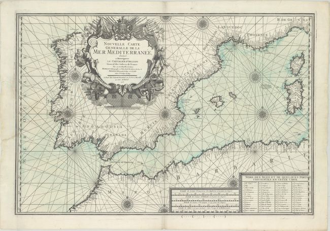
This detailed sea chart by Henri Michelot and Laurent Bremond of the western Mediterranean Sea covers the area from Spain and the Barbary Coast to Corsica and Sardinia. The coasts are filled with place names, and a legend at bottom right lists additional islands and ports shown on the chart. The chart is adorned with rhumb lines, compass roses, three scales of miles, and a large, finely engraved title cartouche that mimics a ship and features navigators, a slave, canons, and other weaponry. Engraved by Peter Starckman.
References:
Condition: A
A dark impression on a bright sheet of watermarked paper with a couple tiny spots. Three tears in blank margins, one of which extends 1" into map image at left, have been archivally repaired.