Subject: Central Italy
Period: 1638 (published)
Publication: Atlas Novus
Color: Hand Color
Size:
19.4 x 14.7 inches
49.3 x 37.3 cm
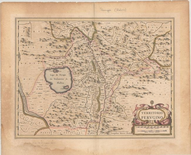
An attractive map of central Italy with the city of Perugia at center and Lake Trasimeno to its west. The Chiana River is located along the left border and the region's hills and valleys dominate the map. Adorned by a decorative title cartouche with distance scale at lower right. Latin text on verso.
References: Van der Krogt (Vol. I) #7340:1.1.
Condition: B
Contemporary color on watermarked paper with a 2" crack below the distance scale due to the oxidation of the green pigment that has been closed on verso with archival tape. There is light toning that is more prominent in the blank margins and some dampstaining in the bottom margin.