Catalog Archive
Auction 184, Lot 553

"Regni Hungariae, et Regionum, quae ei Quondam Fuere Unitae, ut Transilvaniae, Valachiae, Moldaviae, Serviae, Romaniae, Bulgariae, Bessarabiae, Croatiae, Bosniae, Dalmatiae, Sclavoniae, Morlachiae, Ragusanae Reipublciae...", Wit, Frederick de

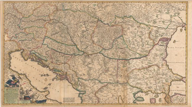
Subject: Southeastern Europe, Hungary

Period: 1688 (dated)

Publication:

Color: Hand Color

Size:
34.9 x 19.6 inches
88.6 x 49.8 cm
Download High Resolution Image
(or just click on image to launch the Zoom viewer)

This large-scale map shows the Kingdom of Hungary stretching from Venice east to the Black Sea, and from Prague south to northern Greece. There is excellent detail of towns, roads, political boundaries, rivers, and the topography of the land. Historical battlefields are marked with crossed swords and brief explanatory notes. The map was published in the midst of the Great Turkish War, as the Ottoman Empire's hegemony in the region began to slip. The title cartouche nods to the conflict, with a winged angel holding a cross and preparing to throw thunderbolts at three Turks. Printed on two joined sheets, as issued.

References:

Condition: B

Contemporary color with light toning and scattered foxing, issued folding. Fold separations that extend 3", 9" and 11" (from right fold to left fold) have been repaired on verso with old paper.

Estimate: $550 - $700

Sold for: $350

Closed on 9/15/2021

Archived