Catalog Archive
Auction 184, Lot 551

NO RESERVE

"Carte de la Mer Noire [on sheet with] Carte du Canal de la Mer Noire", Bellin, Jacques Nicolas
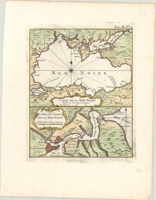
Subject: Black Sea

Period: 1764 (published)

Publication: Le Petit Atlas Maritime

Color: Hand Color

Size:
6.8 x 8.4 inches
17.3 x 21.3 cm
Download High Resolution Image
(or just click on image to launch the Zoom viewer)

This sheet features two maps of the Black Sea. At top is a general map of the region, including the Crimean Peninsula. The map at bottom zooms in on the Bosporus Strait. It identifies Constantinople and notes a Colonne de Pompee, perhaps a nod to the altar atop the mythical Symplegades or Clashing Rocks. The map was published soon after the start of the Russian-Circassian War. During this period the Black Sea was a key strategic location in the power struggle between the British and French empires, the emerging Russian Empire, and the declining Ottoman Empire.

References: Rumsey #6903.219.

Condition: A

A sharp impression on watermarked paper with some printer's ink residue.

Estimate: $80 - $100

Sold for: $65

Closed on 9/15/2021

Archived